Updating the Alabama Weather Situation at 4:30 p.m.
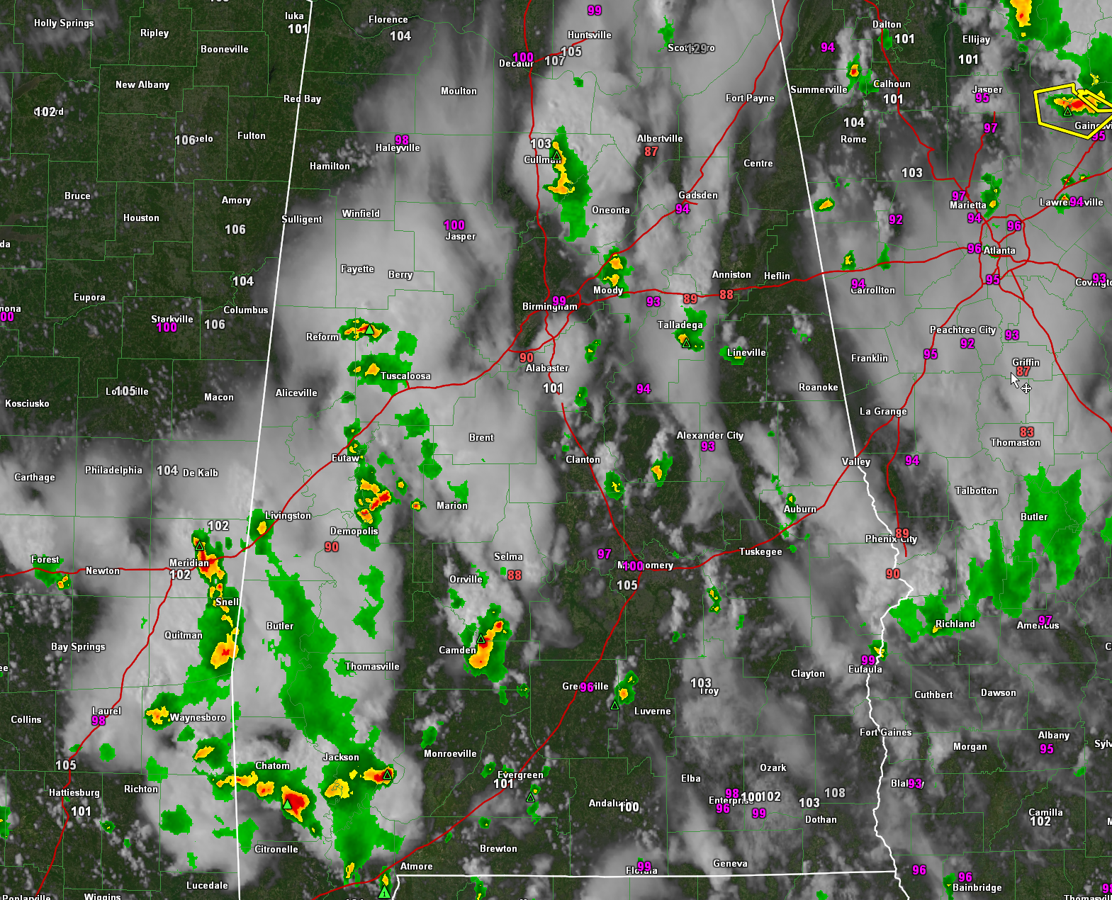
Thunderstorms have been more plentiful across Alabama today with the high heat and instability and the presence of a surface low between Jacksonville and Savannah.
There was a severe thunderstorm warning for northwestern Jefferson County and one is expiring at 4:30 for southeastern Cullman County. The storms in Cullman County extend from east of Cullman to near Hanceville. They are moving southwest though, so they will be crossing US-31 and then I-65 over the next 45 minutes.
Elsewhere, there are strong storms pushing westward out of Tuscaloosa and Hale Counties into Pickens and Greene Counties.
There are strong storms over southwestern St. Clair County about to push into northeastern Jefferson.
Other strong storms are south of Talladega in Talladega County and south of Rockford in Coosa County.
Storms are also scattered across South Central Alabama.
The stronger storms will have strong gusty winds, and damage is possible with any downburst winds that form. Those winds could reach 60 mph. There will also be plenty of dangerous lightning and torrential rain that could cause local flooding.
Category: Alabama's Weather, ALL POSTS, Severe Weather
About the Author (Author Profile)
Bill Murray is the President of The Weather Factory. He is the site's official weather historian and a weekend forecaster. He also anchors the site's severe weather coverage. Bill Murray is the proud holder of National Weather Association Digital Seal #0001 @wxhistorianSubscribe
If you enjoyed this article, subscribe to receive more just like it.


