Hot Summer Days Roll On; Isolated Storms
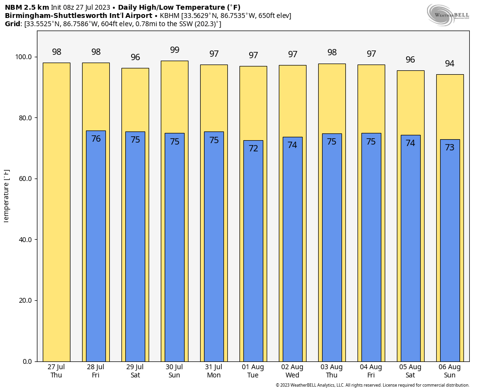
NEW DAY, OLD FORECAST: An upper ridge is stretched out across the southern U.S… and will keep Alabama “toasty” through the weekend with highs in the 90s and lows in the 70s. You can never rule out a brief shower or storm on hot summer days here, but the chance of any one front yard getting wet today and tomorrow is only 10-20 percent. We do note a few showers over the northwest corner of Alabama early this morning.
The number of showers and storms could increase a bit over the weekend thanks to a pocket of slightly colder air aloft, but the chance of any given location seeing rain is still fairly low; 25-35 percent.
NEXT WEEK: The ridge rules. Highs hold in the mid to upper 90s through at least the first half of the week with only isolated afternoon storms. We continue to see evidence the ridge will weaken a bit toward the end of the week, with slightly lower heat levels and slightly higher coverage of scattered showers/storms. See the video briefing for maps, graphics, and more details.
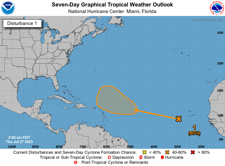
TROPICS: A tropical wave is located a few hundred miles to the southwest of the Cabo Verde Islands. Conditions are expected to be favorable for gradual development of this system later this week, and a tropical depression could form over the weekend or early next week while it moves westward to west-northwestward over the tropical Atlantic. NHC gives this system a 40 percent chance of becoming a tropical depression or storm over the next seven days.
Still no systems are expected near the Gulf of Mexico or the U.S. through next week.
ON THIS DATE IN 1819: A hurricane affected the coast from Louisiana to Alabama. New Orleans was on the fringe of the storm and suffered no severe damage. Ships at the Balize experienced a strong gale for 24 hours that only grounded three ships. Lakes Pontchartrain and Borgne rose five to six feet during the storm, with farms along the lakes flooded by the storm tide. Forty-one lives were lost on the U.S. Man of War schooner Firebrand, a 150-ton gunship.
ON THIS DATE IN 1926: A destructive Category 4 hurricane struck Nassau during the evening hours on the 25th. The hurricane passed just east of Cape Canaveral early on the 28th and made landfall near present-day Edgewater, Florida.
Look for the next video briefing here by 3:00 this afternoon… enjoy the day!
Category: Alabama's Weather, ALL POSTS, Weather Xtreme Videos
About the Author (Author Profile)
James Spann is one of the most recognized and trusted television meteorologists in the industry. He holds the AMS CCM designation and television seals from the AMS and NWA. He is a past winner of the Broadcast Meteorologist of the Year from both professional organizations.Subscribe
If you enjoyed this article, subscribe to receive more just like it.


