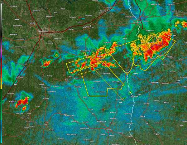
Radar Update…More Storms Overnight That Could Be Severe
Our first round of storms has pushed south of the I-85 Corridor this evening.
It extends from southern Russell County into Bullock, Pike, and southeastern Montgomery Counties.
The strongest storms are south of Sprague, between Midway and Union Springs, and near Pittsview in Russell County.
The storms are weakening a bit, but severe thunderstorm warnings continue for parts of Barbour and Russell, and parts of Bullock, Montgomery, and Pike.
The severe thunderstorm watch has been cancelled for Autauga, Chambers, Dallas, Elmore, Lee, Lowndes, Macon, and Tallapoosa counties. It continues for Barbour, Bullock, Montgomery, Pike, and Russell counties.
Just a heads up that more storms are expected overnight into early Saturday, and they could be severe. They are already forming over the Tennessee Valley.
These storms will increase in coverage and intensity after 2 a.m. as they push slowly southeast. There is a chance of severe weather including damaging winds and hail. There is a not insignificant amount of low level helicity, especially over South Central Alabama, so we can’t rule out the potential of a tornado or two.
As we have said too many times this year, this is one of those nights when you will want to keep your sources of warnings in a place where they will wake you in case warnings are issued.
Category: Alabama's Weather, ALL POSTS, Severe Weather


