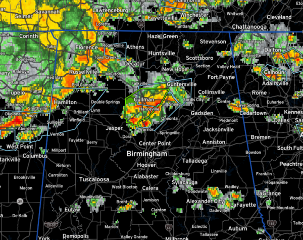
Latest on the Alabama Weather Situation at 4:25
Severe thunderstorm warning continues for parts of Colbert, Franklin, and Lauderdale Counties. Strong storms from south of Leighton to Russellville, Vina, and Hodges. Damaging winds and hail possible. These storms extend down into Okalona and Houston in eastern Mississippi. They are entering northwestern Marion County, west of Hamilton. They will be entering Lamar, Fayette, and Pickens Counties over the next hour.
Flash flood warning for Cullman County. Heavy thunderstorms near Cullman, Holly Pond, Good Hope and Hanceville. Another core is just west of Hayden in Blount County. Rainfall rates are approaching 2″ per hour near the city of Cullman.
Storms will continue pushing east southeast across North and North Central Alabama this afternoon. Some of them will be strong to severe.
There are scattered strong storms across Central Alabama from Moundville to south of Brent to northern Tallapoosa County into Chambers County.
A severe thunderstorm watch continues until 9 p.m. for the Tennessee Valley Counties on North Alabama.
Category: Alabama's Weather, ALL POSTS, Severe Weather


