Another Afternoon of Strong Storms, Damaging Wind Gusts
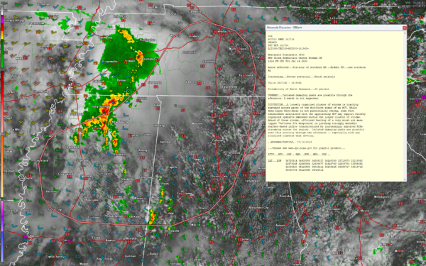
The airmass over western Alabama and eastern Mississippi is strongly unstable this afternoon, with CAPE values running 4,000-5,5000 joules/kg. There is not very much shear at all, but strong storms are already forming across Pickens, Sumter, and Greene Counties, where they do not need any more heavy rains. There storms will approach Tuscaloosa in about 90 minutes.
Upstream, an area of intensifying storms is over northern Mississippi. A severe thunderstorm warning is in effect now for Pontotoc, Union, and Lee Counties just south of New Albany. That storm is producing a dizzying 86 flashes of lightning per minute. It may have hail to the size of nickels or larger. The greater threat from the storms this afternoon is damaging wind gusts. Tornadoes will not be an issue.
These storms are aided by an MCV that is pushing east southeastward at about 25 mph. It should reach Franklin, Marion, and Lamar Counties around 2:30 p.m.
The SPC has issued a mesoscale discussion, as can be seen on the graphic. But they do not expect to issue a severe thunderstorm watch at this time.
Category: Alabama's Weather, ALL POSTS, Severe Weather


