Midday Nowcast: Tropical Air Mass Leads to Tropical Downpours
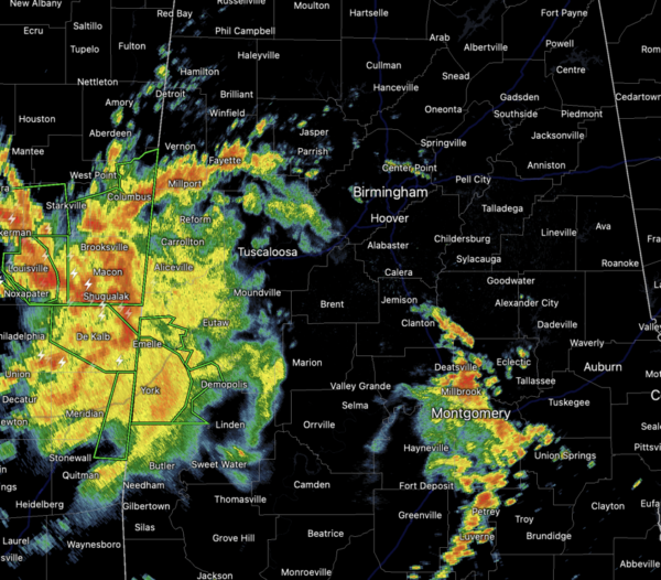
OCEAN OF HUMIDITY: Moisture levels are surging across Alabama as dew points are likely to be in the mid to upper 70s for the foreseeable future. Higher humidity means higher rain chances and we are seeing that today as rain continues to increase in coverage across Alabama.
Through the weekend, we will see scattered to numerous shower and storms each day, but also we will keep an eye on potential thunderstorm clusters riding around the edge of the ridge. Rain chances will be in the 50%-70% range for much of Alabama. Expect partly sunny days with highs in the low 90s. It won’t rain every where each day, but each day, the radar will be active with rain and storms….keep the umbrella close.
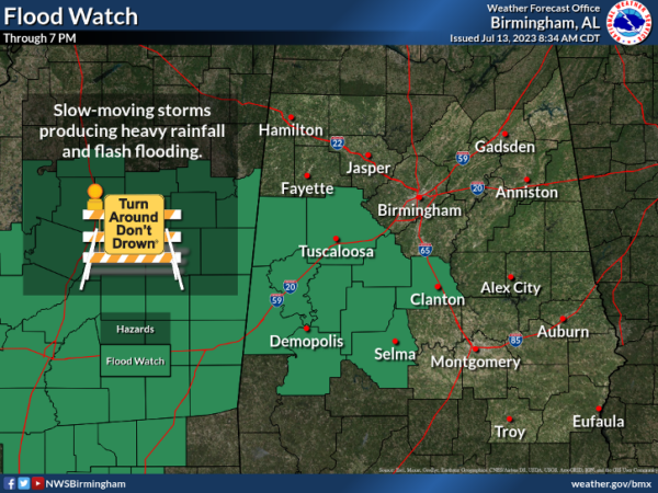
Also, summer storms will produce gusty winds, tremendous amounts of lightning, and tropical downpours, which can and will lead to areas of isolated flash flooding. Today, there is a flood watch in effect for portions of West Alabama, where are are already seeing flash flood warnings. Never drive through flood waters, TURN AROUND, DON’T DROWN!!!
NEXT WEEK: The ridge to the west will intensify and begin to expand east, meaning our temperatures will be climbing higher while rain chances will decrease and become more isolated. Mid to upper 90s are expected across Alabama and with high dew points, we are likely to see another round heat alerts across Alabama as heat index values will likely exceed the 105° danger range. Be prepared!!!
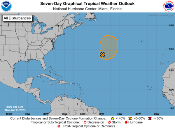
IN THE TROPICS: An area of low pressure located more than 800 miles east of Bermuda continues to produce disorganized showers and thunderstorms well to the east and southeast of its ill-defined center. Environmental conditions are forecast to be somewhat conducive for this system to become a subtropical depression or storm during the next couple of days while it meanders over the central Atlantic. By the weekend, the low should turn northward bringing the system over cooler waters, potentially limiting additional development. Formation chance through 48 hours…medium…60 percent. Formation chance through 7 days…medium…60 percent.
BEACH FORECAST CENTER: Get the latest weather and rip current forecasts for the beaches from Fort Morgan to Panama City on our Beach Forecast Center page. There, you can select the forecast of the region that you are interested in visiting.
WORLD TEMPERATURE EXTREMES: Over the last 24 hours, the highest observation outside the U.S. was 119.3F at Bouira, Algeria. The lowest observation was -97.1F Vostok, Antarctica.
CONTIGUOUS TEMPERATURE EXTREMES: Over the last 24 hours, the highest observation was 118F at Death Valley, CA. The lowest observation was 30F at Mackay, ID.
Category: Alabama's Weather, ALL POSTS


