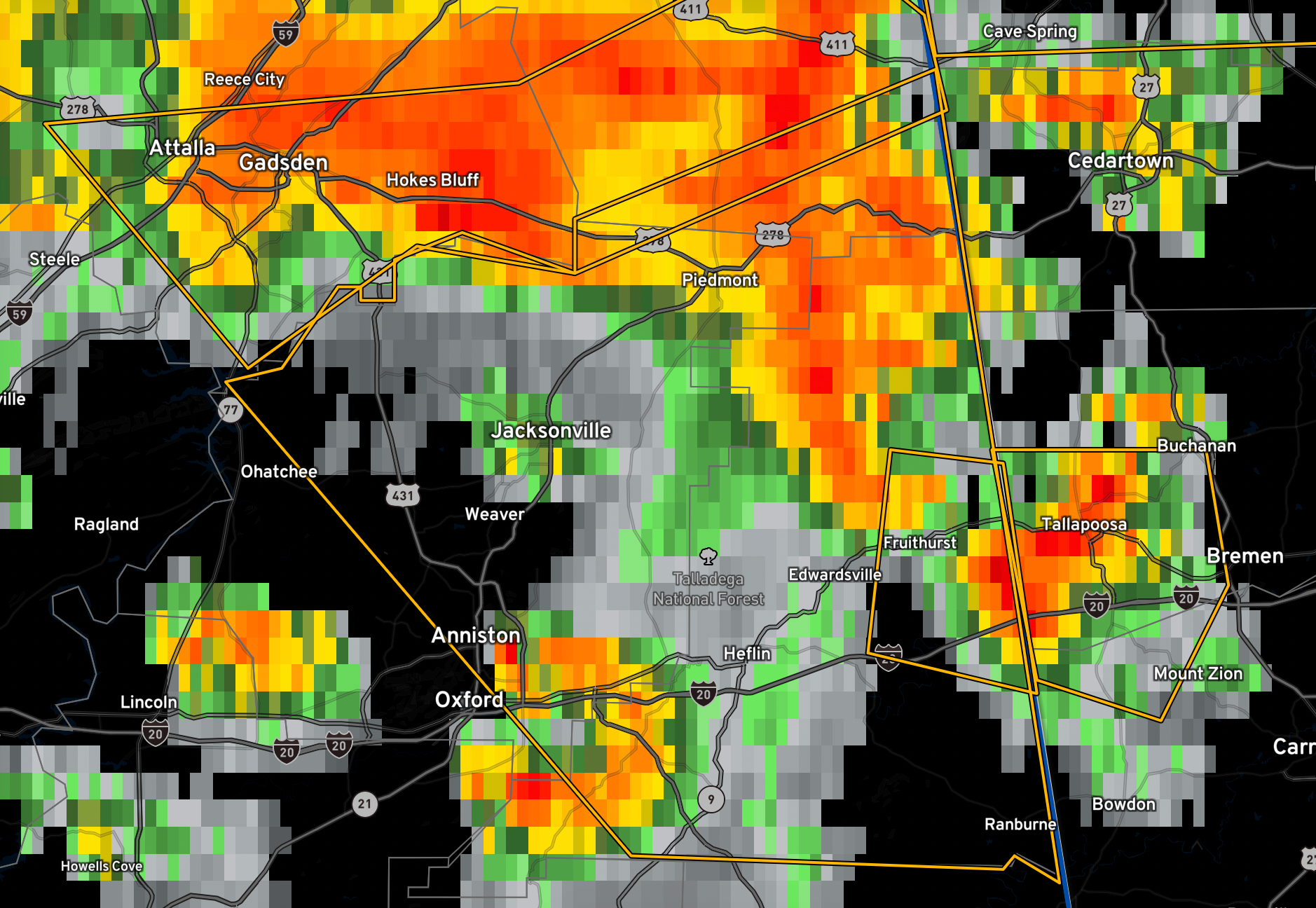
The National Weather Service in Birmingham has issued a
* Severe Thunderstorm Warning for…
Calhoun County in east central Alabama…
Cleburne County in east central Alabama…
Southeastern Cherokee County in northeastern Alabama…
* Until 600 PM CDT.
* At 437 PM CDT, severe thunderstorms were located along a line
extending from Centre Municipal Airport to Ballplay to Attalla,
moving southeast at 35 mph.
HAZARD…60 mph wind gusts.
SOURCE…Radar indicated.
IMPACT…Expect damage to roofs, siding, and trees.
* Locations impacted include…
Anniston, Oxford, Jacksonville, Piedmont, Heflin, Fort McClellan,
Saks, Glencoe, Weaver, Ranburne, Fruithurst, Edwardsville, Pleasant
Gap, Blue Mountain, Alexandria, Jacksonville State University,
Muscadine, Abernathy, Mars Hills and Southside.
Category: Alabama's Weather, ALL POSTS, Severe Weather
About the Author (Author Profile)
Bill Murray is the President of The Weather Factory. He is the site's official weather historian and a weekend forecaster. He also anchors the site's severe weather coverage. Bill Murray is the proud holder of National Weather Association Digital Seal #0001 @wxhistorianSubscribe
If you enjoyed this article, subscribe to receive more just like it.


