Midday Nowcast: Trending Drier and Hotter
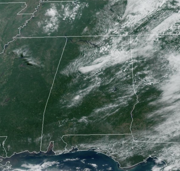
FINALLY FRIDAY: More sunshine and heat today as the upper low finally pulls away from the state. A few isolated showers/storms remain possible across the eastern counties of the state, but most of Alabama will remain dry today with highs returning to the upper 80s.
WEEKEND WEATHER: Tomorrow will be mainly sunny and hot as highs surge into the lower 90s across much of Alabama. On Sunday, due to northwest flow across the state, a weak low pressure and associated front will slide into the Southeast, so we will increase rain chances late Sunday and into Monday. Most of Sunday should be dry with highs in the low 90s, but Sunday into Monday, rain and a few strong storms will be possible.
NEXT WEEK: On Tuesday, an upper ridge to the west continues to intensify and expand eastward. That means partly to mostly sunny days, highs in the low 90s, with isolated, mainly afternoon and evening showers and storms. Rain chances will be in the 10-20%. Towards the end of the week, depending on how strong to ridge becomes, highs could easily climb into the mid and upper 90s across Alabama. Heat index values could easily surge to the low 100s. Get ready, soon then later, summer heat is coming.
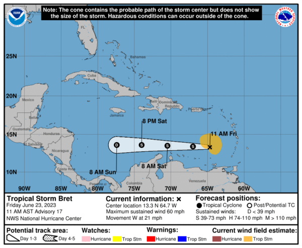
TROPICAL STORM BRET: The center of Tropical Storm Bret was located near latitude 13.3 North, longitude 64.7 West. Bret is moving toward the west near 21 mph and this general motion is expected to continue through the weekend. On the forecast track, the center of Bret will continue moving westward away from the Windward Islands and across the eastern and central Caribbean Sea during the next couple of days.
Maximum sustained winds remain near 60 mph with higher gusts. Weakening is forecast during the next couple of days, and Bret is expected to dissipate over the central Caribbean Sea by Sunday. Tropical-storm-force winds extend outward up to 125 miles from the center. The estimated minimum central pressure based on data from the Air Force Hurricane Hunters is 1002 mb (29.59 inches).
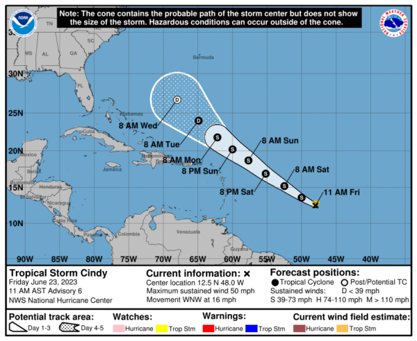
TROPICAL STORM CINDY: The center of Tropical Storm Cindy was located near latitude 12.5 North, longitude 48.0 West. Cindy is moving toward the west-northwest near 16 mph and this general motion is expected to continue over the next few days. On the forecast track, the system is expected to remain well east and northeast of the northern Leeward Islands through early next week.
Maximum sustained winds have increased to near 50 mph with higher gusts. Some additional strengthening is forecast over the next day or so followed by gradual weakening afterwards. Tropical-storm-force winds extend outward up to 60 miles from the center. The estimated minimum central pressure is 1003 mb (29.62 inches).
BEACH FORECAST CENTER: Get the latest weather and rip current forecasts for the beaches from Fort Morgan to Panama City on our Beach Forecast Center page. There, you can select the forecast of the region that you are interested in visiting.
WORLD TEMPERATURE EXTREMES: Over the last 24 hours, the highest observation outside the U.S. was 118.0F at Bandar-E-Dayyer, Iran. The lowest observation was -93.8F Concordia, Antarctica.
CONTIGUOUS TEMPERATURE EXTREMES: Over the last 24 hours, the highest observation was 116F at Rio Grande Village, TX. The lowest observation was 21F at Mackay, ID.
Category: Alabama's Weather, ALL POSTS


