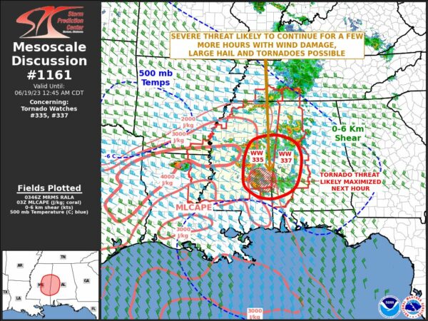
All Modes of Severe Weather Remain Possible Across the Tornado Watch Locations
The severe threat is likely to continue for a few more hours, with wind damage, large hail, and tornadoes possible. Here is the text from the latest mesoscale discussion…
The severe weather threat for Tornado Watch 335, 337 continues.
SUMMARY… A severe threat will likely continue over the next few hours across eastern Mississippi and western Alabama. Tornadoes, wind damage and isolated large hail will be possible.
DISCUSSION… High-resolution radar imagery from Jackson shows a cluster of strong to severe storms located across central and eastern Mississippi. The storms are located along the eastern edge of a moderately unstable airmass, where surface dewpoints are in the 70s F and MLCAPE is estimated in the 2000 to 3000 J/kg range by the RAP. Over the next couple of hours, the RAP moves a low-level jet across eastern Mississippi and strengthens the jet to near 40 knots. This will maintain strong low-level shear, helping to continue the tornado threat across eastern Mississippi. The threat should gradually move eastward into western Alabama over the next couple of hours. In addition, supercells will potentially be capable of producing large hail and wind damage.
Category: Alabama's Weather, ALL POSTS, Severe Weather


