All’s Calm at Midday
It is mostly sunny and warm here at early afternoon across North and Central Alabama.
Clouds have been slow to clear over Southwest Alabama. One lone thunderstorm is over Clarke County and developing showers are across Washington, northern Baldwin and Escambia County.
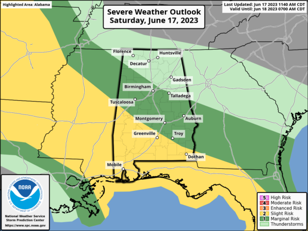
The SPC has a slight risk (level 2 out of 5) over South and Coastal Alabama through tonight with a marginal risk (level 1 out of 5) for areas south of I-22 and US-280.
Hail is the big issue again for South Alabama. The SPC has everywhere from Biloxi to Apalachicola in a hatched outlook for significant hail 2″ or greater in diameter. Wind damage is also a big threat. There is a small tornado threat in faro South Alabama, with a slight better chance over Northwest Florida.
The HRRR is not bullish on storms even down South but it hasn’t been doing the best job lately. It sees some scattered storms over Southwest and South Alabama this afternoon and over the Florida Panhandle. It sees a strong batch of storms coming across Mississippi tonight but weakens it as it approaches Alabama.
The NAM3k has been a little better. It paints the scattered afternoon storms over South Alabama and the Florida Panhandle, and the first batch of storms approaching western Alabama around sunrise, but weakening as it does.
Both models pick up on another cluster diving into Southwest Alabama around noon tomorrow.
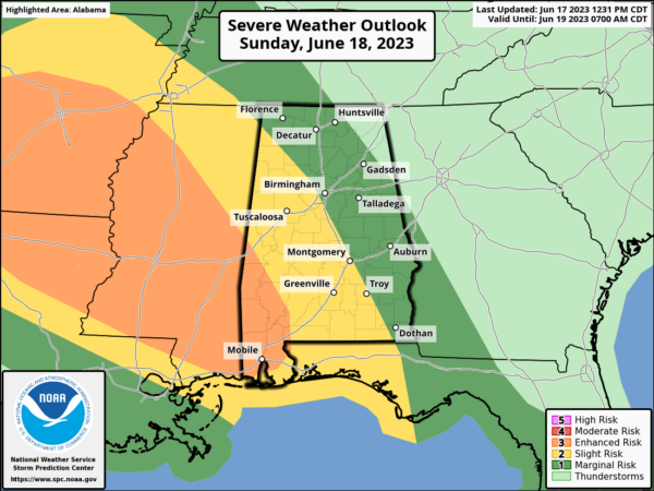
Another bigger round of storms moves into West Alabama Sunday evening, but it will be weakening as well as it pushes east. Still could bring large hail and damaging winds. The SPC has a larger enhanced area (3/5) up for tomorrow and tomorrow night for Alabama and Mississippi.
Have a great rest of the day and Father’s Day tomorrow. We will have frequent updates when the storms start firing.
Category: Alabama's Weather, ALL POSTS, Severe Weather


