Damaging Wind & Hail Threat Continues for a Little While Longer
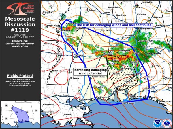
SUMMARY… The risk for large hail and damaging winds continues across WW320. Damaging wind potential may be increasing across southwest AL in the next 1–2 hours.
DISCUSSION… Ongoing severe storms across portions of the severe thunderstorm watch have continued to maintain intensity, with numerous reports of large hail from supercells in northwest and southeastern MS. The severe risk will likely continue this evening, with large buoyancy and vertical shear still plentiful for organized supercells capable of large to very large hail. The second cluster of storms across western AL have grown upscale over the last hour. Hints of a bowing structure and stronger radial velocities aloft suggest the cold pool is likely intensifying, aiding in further upscale growth. Vertical shear and buoyancy remain favorable for strong updraft maintenance this evening, with an increasing risk for damaging winds in addition to hail across portions of southwestern AL over the next couple of hours.
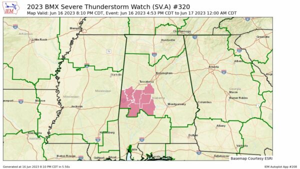
The severe thunderstorm watch continues for Bibb, Dallas, Greene, Hale, Marengo, Perry, and Sumter counties until 12 AM.
Category: Alabama's Weather, ALL POSTS, Severe Weather


