Scattered To Numerous Storms Again Tomorrow
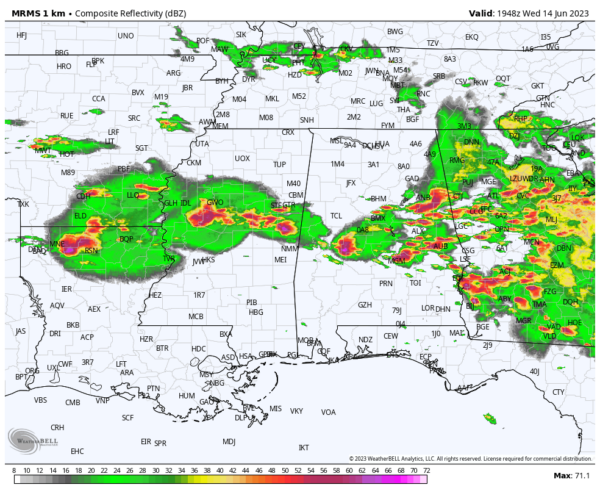
BUSY DAY: As expected, we have numerous severe thunderstorms in progress across the southern 2/3 of Alabama this afternoon. The stronger storms are producing large hail and damaging winds, and tornadoes touched down late this morning near Abbeville and Eufaula, in Southeast Alabama. A tornado watch remains in effect for areas south and east of Birmingham through 5:00; a new watch will likely be needed for some of the southern counties.
Continue to be weather aware and pay attention to warnings as they are issued this evening.
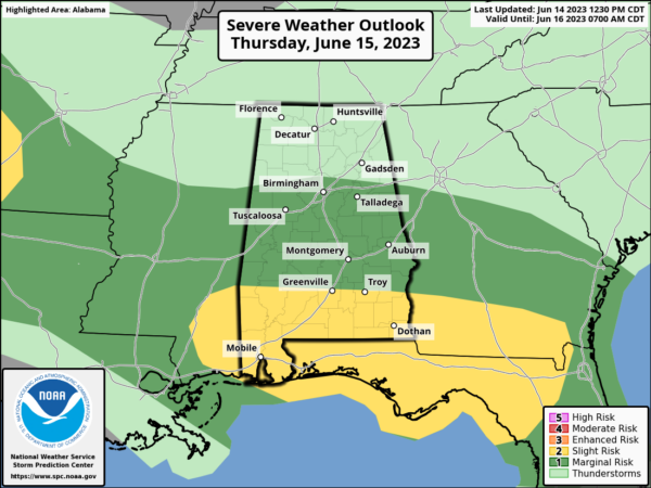
TOMORROW/FRIDAY: Scattered to numerous showers and storms are likely statewide tomorrow, but the severe weather risk will be mainly limited to the southern half of the state. The main concerns tomorrow will come from hail and strong winds… there is just a low end threat of a brief tornado across South Alabama.
The weather trends drier Friday, but widely scattered storms are possible, and they could be strong where they form.
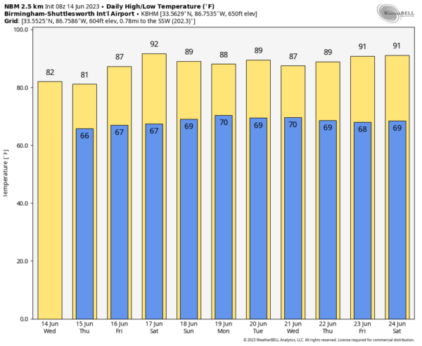
THE ALABAMA WEEKEND: We will need to mention scattered showers and thunderstorms Saturday and Sunday, but the weekend won’t be a wash-out. We note SPC has defined a risk of severe storms over Northwest Alabama Sunday. There will be intervals of sun with highs in the 80s.
NEXT WEEK: For now we expect fairly typical summer weather with partly sunny days and “scattered, mostly afternoon and evening showers and thunderstorms” on a daily basis. Highs will be in the 88-91 degree range most days… See the video briefing for maps, graphics, and more details.
ON THIS DATE IN 1903: Major flash flooding along Willow Creek destroyed a significant portion of Heppner, Oregon on this day. With a death toll of 247 people, it remains the deadliest natural disaster in Oregon.
Look for the next video update here by 6:00 a.m. tomorrow…
Category: Alabama's Weather, ALL POSTS, Weather Xtreme Videos


