West Alabama Storms Very Dangerous
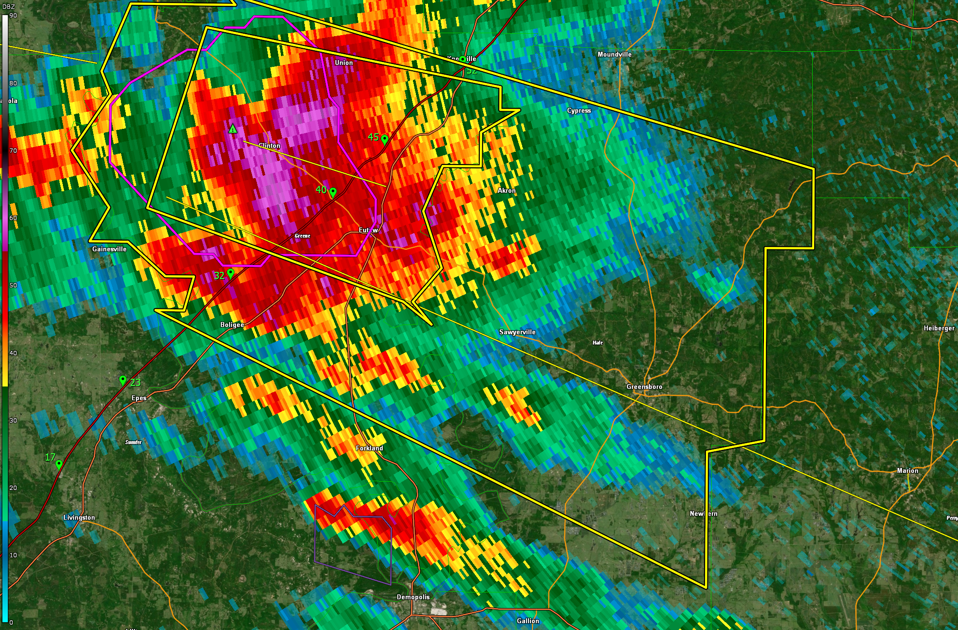
Tracking severe storms now crossing I-59/20 between MM 30 and 50 or between Boligee and Knoxville.
They show high probability of damaging winds up to 70 mph. Also 2 inch hail and 45 lightning flashes per minute. As well as torrential rains.
The storm is feeding on very unstable air, between 3,000-3,600 joules/kg. It has plenty of wind shear to keep it organized. Right now not enough to produce a tornado, but we will be watching.
Akron, Sawyerville, and Greensboro are in the direct path.
It will move in the general direction of Marion, Selma, and Montgomery over the next couple of hours.
Category: Alabama's Weather, ALL POSTS, Severe Weather
About the Author (Author Profile)
Bill Murray is the President of The Weather Factory. He is the site's official weather historian and a weekend forecaster. He also anchors the site's severe weather coverage. Bill Murray is the proud holder of National Weather Association Digital Seal #0001 @wxhistorianSubscribe
If you enjoyed this article, subscribe to receive more just like it.


