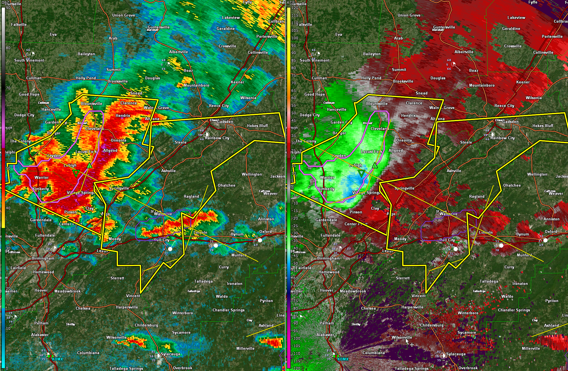
High Probability of Wind Damage Now for Blount, northeastern Jefferson, St. Clair and Etowah Counties
High probability of wind damage is imminent for Oneonta, Allgood, Village Springs, Clay, and Argo…moving into the rest of southern Etowah and St. Clair counties.
Be in your safe place on the lowest floor of a site built home or building in a center room away from outside walls and windows. Do not be driving as these storms approach.
New severe thunderstorm for round two for St. Clair and southern Etowah…
The National Weather Service in Birmingham has issued a
* Severe Thunderstorm Warning for…
Southern Etowah County in northeastern Alabama…
St. Clair County in central Alabama…
* Until 245 PM CDT.
* At 145 PM CDT, severe thunderstorms were located along a line
extending from near Cleveland to near Clay to near Morris, moving
southeast at 60 mph.
HAZARD…70 mph wind gusts and quarter size hail.
SOURCE…Emergency management.
IMPACT…Hail damage to vehicles is expected. Expect considerable
tree damage. Wind damage is also likely to mobile homes,
roofs, and outbuildings.
* Locations impacted include…
Gadsden, Pell City, Leeds, Moody, Rainbow City, Attalla, Hokes
Bluff, Springville, Odenville, Lincoln, Glencoe, Margaret, Argo,
Ashville, Ragland, Steele, Altoona, Bald Rock, Harrisburg and
Branchville.
Category: Alabama's Weather, ALL POSTS, Severe Weather
About the Author (Author Profile)
Bill Murray is the President of The Weather Factory. He is the site's official weather historian and a weekend forecaster. He also anchors the site's severe weather coverage. Bill Murray is the proud holder of National Weather Association Digital Seal #0001 @wxhistorianSubscribe
If you enjoyed this article, subscribe to receive more just like it.


