Alabama at 11:35 a.m.: A Flock of Hook Echoes
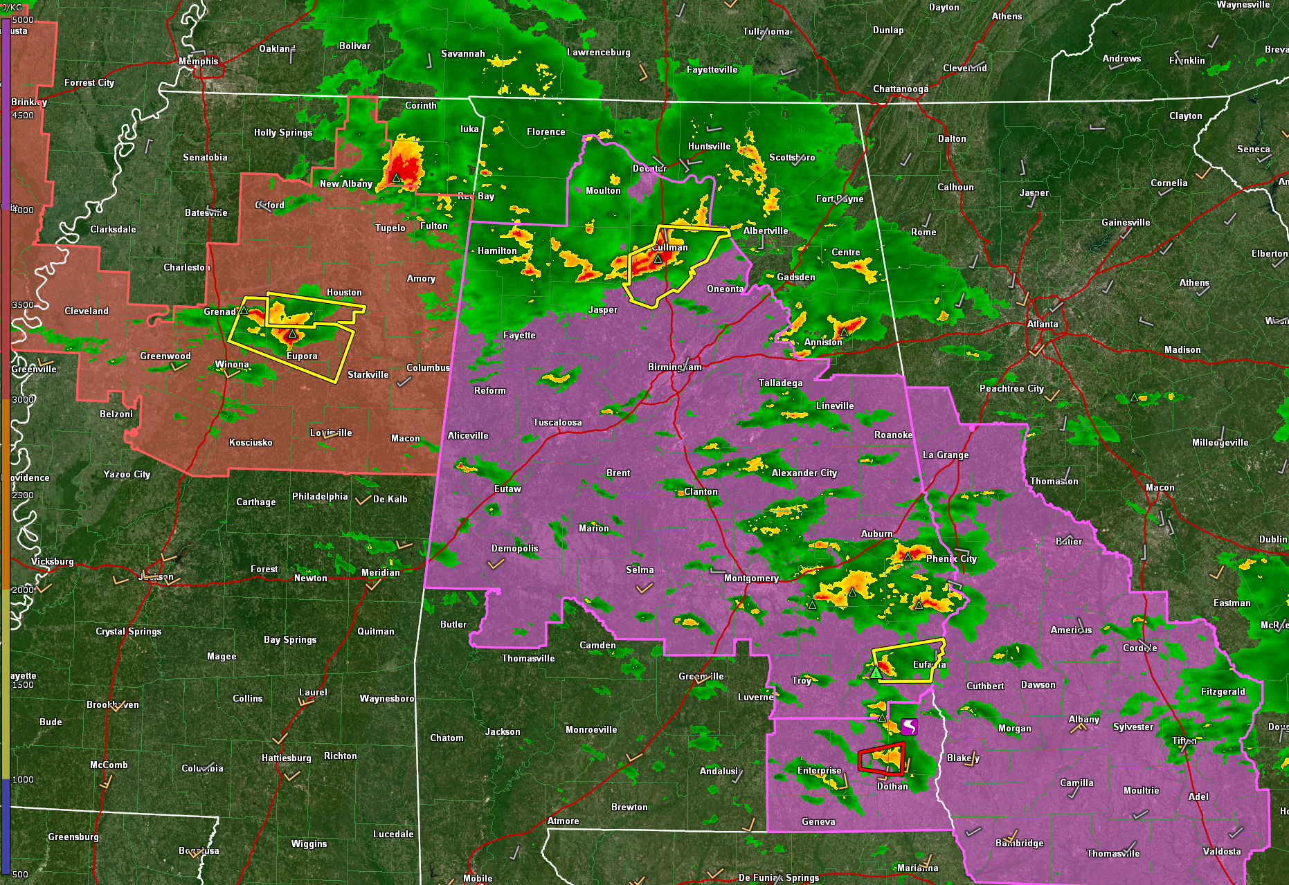
Tornado warnings continue over Southeast Alabama where an extremely anomalous jet streak is causing what John DeBlack at the NWS Birmingham calls a “flock of hook echoes”.
A tornado was reported by Forestry officials near Abbeville around 10:40 a.m.
Additional tornado warnings have been issued for areas north of Enterprise and near Dothan.
A new tornado watch has been issued for Southeast Alabama and southwestern Georgia.
There is a storm west of Eufaula that could take advantage of these same upper dynamics. A severe thunderstorm warning is in effect for Barbour County now.
Over North Alabama, the storms have weakened a bit. The warnings have expired for Winston County. There is a severe thunderstorm warning in effect for Cullman County. The most dangerous storms are approaching I-65 and the city of Cullman.
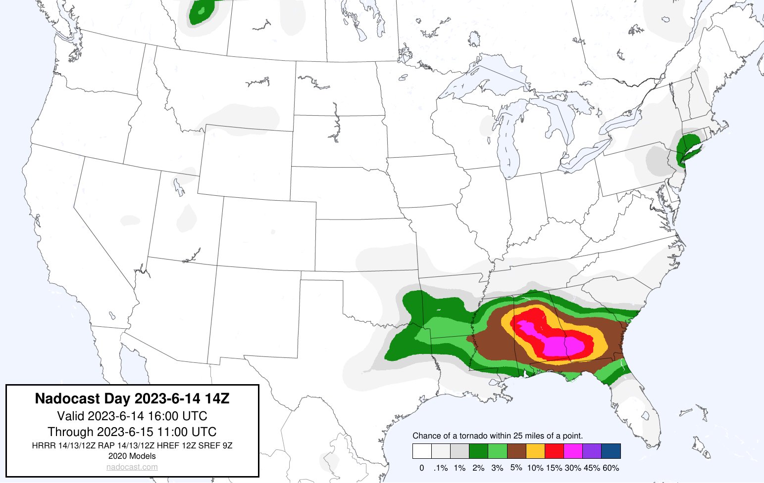
The airmass south of a line from Fayette to Birmingham to Auburn is substantially more unstable and there is an unusual amount of bulk shear, which will keep the storms organized. I am concerned that there could be a couple of tornadoes in US-82 Corridor from Fayette and Tuscaloosa down to Brent and Prattville and Montgomery down into Southeast Alabama. This is from our friends over at Nadocast…
The storms in Mississippi that will be approaching Starkville will be important to watch as they move into this corridor of higher instability. There seems to be more vorticity with this complex of storms as well, which may enhance the tornado threat a bit.
Remain vigilant through the afternoon.
Category: ALL POSTS
About the Author (Author Profile)
Bill Murray is the President of The Weather Factory. He is the site's official weather historian and a weekend forecaster. He also anchors the site's severe weather coverage. Bill Murray is the proud holder of National Weather Association Digital Seal #0001 @wxhistorianSubscribe
If you enjoyed this article, subscribe to receive more just like it.


