Midday Nowcast: Multiple Rounds of Strong and Severe Storms this Week
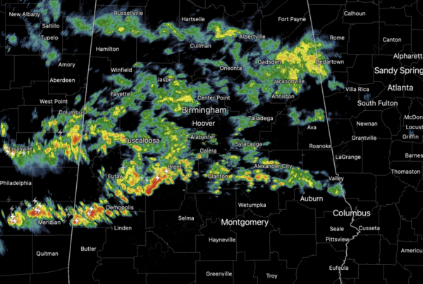
DAILY SEVERE STORMS: Strong clusters of storms will continue to highlight our forecast across Alabama the next few days. These storms will be capable of producing damaging wind gusts, as high as 70-80 mph, and very large hail, golf ball to baseball size. Very rare for Alabama, but this week it is likely in some spots across the state. A few isolated tornadoes are possible, but are not the main threats this week. Additionally, tremendous amounts of lightning and heavy rainfall will occur, including the threat of flash flooding.
THE SETUP: A frontal boundary stalled across the Deep South continues to act like a train track for complexes of storms that develop to the west, and then ride east along the boundary. We have to keep a careful watch on these mesoscale convective systems (MCS) due to the significant threats they pose the next several days.
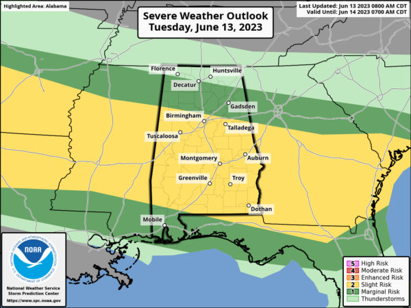
REST OF TODAY: The SPC maintains a “slight risk” (level 2/5) of severe thunderstorms for much of Central and South Alabama, with marginal risks (level 1/5) to the north and south. Widespread rain and storms are ongoing and will be capable of producing strong winds and hail. The high today will be in the 80s for most places, with low 90s possible for the southern quarter of the state.
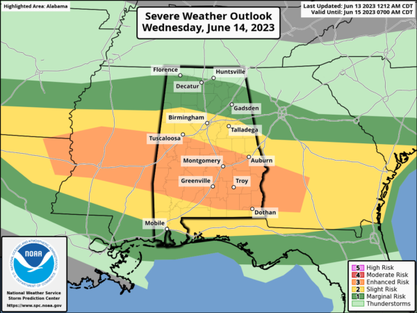
TOMORROW/THURSDAY: Tomorrow the SPC has defined an “enhanced risk” (level 3/5) for parts of Central and South Alabama, including cities like Demopolis, Selma, Montgomery, Greenville, Monroeville, Troy, and Eufaula. “Slight” and “marginal” risks surround the enhanced risk to cover much of the state.
Tomorrow’s round of storms could be the strongest of the week with widespread severe weather likely. Tomorrow’s threat will include isolated tornadoes, especially in the “enhanced risk”, but winds and hail continue to be the main concerns. Winds of 70-80 mph are possible, and again, baseball size hail. Highs will remain in the 80s for most places.
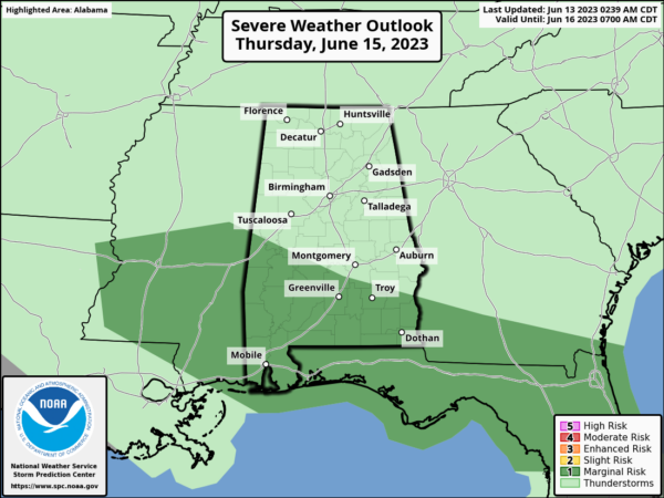
Again, it will not be raining or storming all the time, and these threats will come with each cluster of storms we see through Thursday. Along with the severe weather threat the next few days, we are going to see very heavy rainfall with each complex of storms. Rainfall totals through Thursday across Alabama will range from 2”-6” which could cause flash flooding issues.
CALL TO ACTION: Have multiple, reliable ways to receive severe weather alerts, know your safe place at home, school, and/or work. On your smartphone, be sure emergency alerts are enabled (look under settings, and notifications). Take severe thunderstorm warnings very seriously this week, as some of these storms will be capable of producing considerable damage. Tell your friends, neighbors, and relatives about the threat, and what they need to do to get ready. And, if they fall in a warning polygon, call them or text them to let them know about the threat. You are our most valuable resource in spreading the word!
FRIDAY AND THE WEEKEND: For Friday, showers and storms thin out some, and the day should be mostly sunny with a high around 90°. For Saturday and Sunday, moist air returns along with the chance of showers and thunderstorms both days. Expect scattered showers and storms with afternoon highs ranging from the upper 80s to lower 90s.
NEXT WEEK: Fairly routine weather next week with partly sunny days with scattered, mostly afternoon and evening showers and thunderstorms. Highs will be close to 90° through the week.
IN THE TROPICS: All is quiet in the Gulf of Mexico, Caribbean Sea, and the open waters of the Atlantic. With no development expected through the upcoming weekend.
BEACH FORECAST CENTER: Get the latest weather and rip current forecasts for the beaches from Fort Morgan to Panama City on our Beach Forecast Center page. There, you can select the forecast of the region that you are interested in visiting.
WORLD TEMPERATURE EXTREMES: Over the last 24 hours, the highest observation outside the U.S. was 119.7F at Ahwaz, Iran. The lowest observation was -92.7F Vostok, Antarctica.
CONTIGUOUS TEMPERATURE EXTREMES: Over the last 24 hours, the highest observation was 113F at Rio Grande Village, TX. The lowest observation was 28F at Black River Falls, WI.
Category: Alabama's Weather, ALL POSTS, Severe Weather


