Midday Nowcast: Daily Risk of Strong Storms
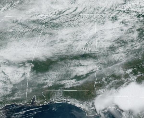
MCS SEASON: A frontal boundary is stalled across the Deep South, stretching from West Texas to the Carolina Coast. This boundary is and will be the focal point of showers and storms today and the next several days for Alabama. The boundary alone will help enhance our rain chances, but it will also act as a track for complexes of storms that develop in the Plains, to ride east along. These mesoscale convective systems (MSC) are common during the summer months and can produce damaging wind gusts and as they travel hundreds of miles. We are likely to see several of these move from the Plains into the Southeast along the boundary the next few days.
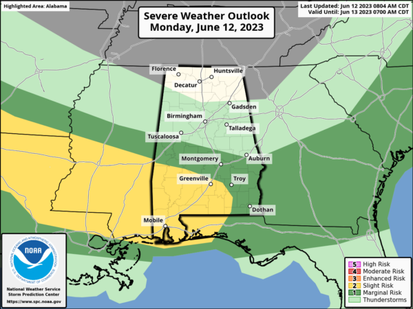
REST OF TODAY: Showers and thunderstorms will develop this afternoon, mainly over the southern half of the state, where the SPC maintains a “slight risk” (level 2/5) of severe storms for Southwest Alabama, with a “marginal risk” (level 1/5) as far north as Greensboro, Wetumpka, and Phenix City.
Like last night, the threats with the heavier storms today will come from strong winds and hail. For the northern half of Alabama, today will be mostly dry with a mix of sun and clouds. Highs will be in the 80s statewide.
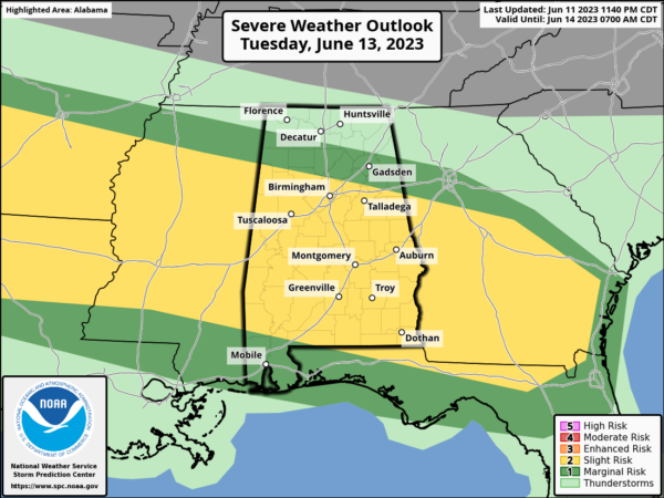
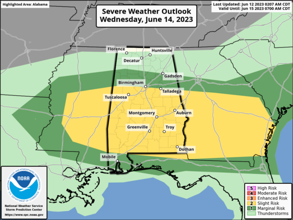
ACTIVE WEATHER WEEK: We expect multiple rounds of thunderstorms across Alabama tomorrow through Thursday. When the storms coming rolling through, they will be strong and locally severe.
The SPC has a much of Alabama in a level 1 or 2 severe weather threat tomorrow and Wednesday due to the hail/wind potential with storms. Before and after the storms, the sky will feature more clouds than sun each day, and highs will remain in the 80s.
FRIDAY AND THE WEEKEND: For Friday, the day should be mostly sunny with a high around 90°. The risk of a shower for now looks very well. For Saturday and Sunday, moist air returns along with the chance of showers and thunderstorms both days. Expect scattered showers and storms with afternoon highs ranging from the upper 80s to lower 90s. Rain amounts across Alabama between now and Sunday night will exceed 4 inches in spots.
INTO NEXT WEEK: Fairly routine weather next week with partly sunny days with scattered, mostly afternoon and evening showers and thunderstorms. Highs will be close to 90° through the week.
IN THE TROPICS: All is quiet in the Gulf of Mexico, Caribbean Sea, and the open waters of the Atlantic. With no development expected through the upcoming weekend.
BEACH FORECAST CENTER: Get the latest weather and rip current forecasts for the beaches from Fort Morgan to Panama City on our Beach Forecast Center page. There, you can select the forecast of the region that you are interested in visiting.
WORLD TEMPERATURE EXTREMES: Over the last 24 hours, the highest observation outside the U.S. was 119.1F at Basrah-Hussen, Iraq. The lowest observation was -88.6F Vostok, Antarctica.
CONTIGUOUS TEMPERATURE EXTREMES: Over the last 24 hours, the highest observation was 111F at Rio Grande Village, TX. The lowest observation was 28F at Black River Falls, WI.
Category: Alabama's Weather, ALL POSTS


