Severe Weather Threat Over for North and Central Alabama
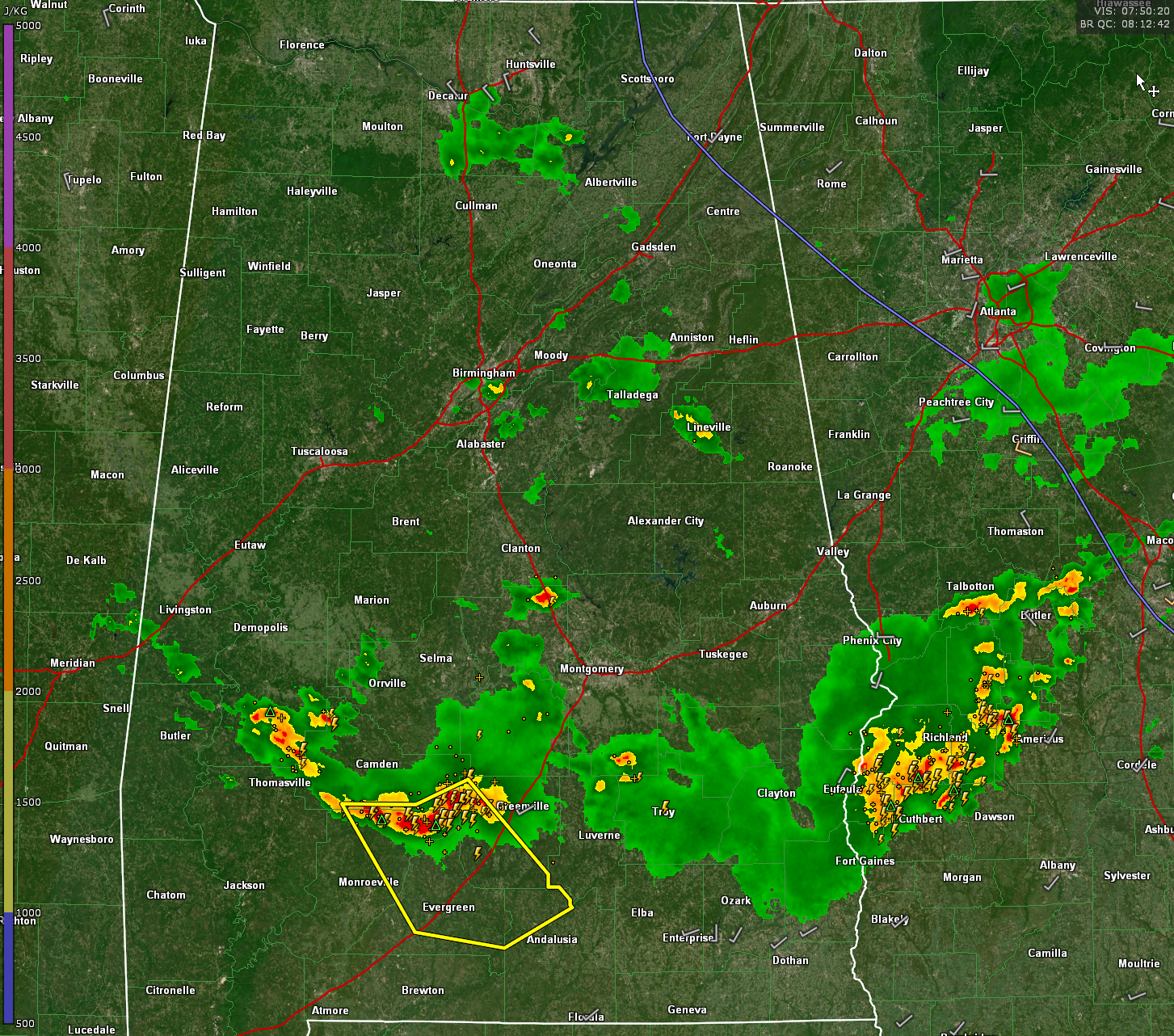
The strongest storms in the state now are over Southwest Alabama. The NWS in Mobile maintains a large severe thunderstorm warning for storms from west of Greenville back into Northern Monroe County. Those storm extend back up into Marengo County, but there they aren’t severe.
There is a storm on I-65 south of Verbena. There is one in the Birmingham area along US-280 to the northeast of Meadowbrook. Some heavy rain is affecting downtown Birmingham as well.
There is a small cell in eastern Clay County east of Ashland.
Strong storms have just crossed over into Georgia from the Phenix City area.
The remaining threat for severe weather is over South Alabama, so I will bid you good night. Tomorrow should feature mainly dry conditions in North and Central Alabama with just a few showers forming around midday. South Alabama will deal with storms, and the SPC has a good part of South Alabama under a marginal or a slight risk for severe weather. Storms are expected to refire there tomorrow evening, but they don’t look as strong as tonight’s storms were.
Category: Alabama's Weather, ALL POSTS, Severe Weather
About the Author (Author Profile)
Bill Murray is the President of The Weather Factory. He is the site's official weather historian and a weekend forecaster. He also anchors the site's severe weather coverage. Bill Murray is the proud holder of National Weather Association Digital Seal #0001 @wxhistorianSubscribe
If you enjoyed this article, subscribe to receive more just like it.


