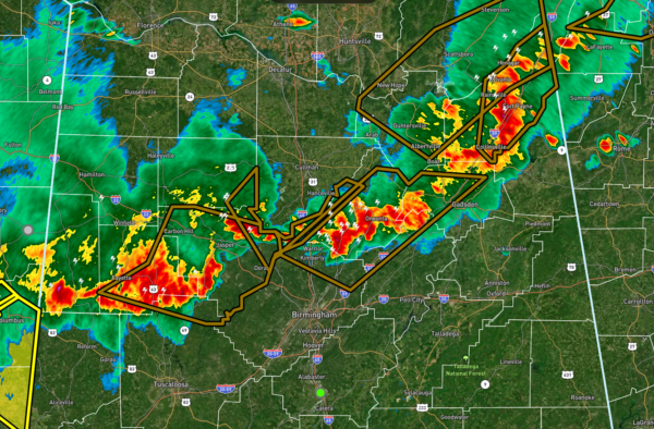
Strong Storms Approaching Jefferson & Tuscaloosa Counties
Strong storms are slowly moving southeastward across Central Alabama and are now approaching and crossing the I-59 corridor. While these are under severe criteria at the moment, you can still expect wind gusts up to 40 mph and hail up to peas size possible. Once you get behind this ragged line of storms, the severe threat will be over for the night. As a matter of fact, NWS Huntsville will probably cancel all of their counties from the Severe Thunderstorm Watch shortly after the storms exit DeKalb County.
There is plenty of instability out ahead of this line of storms, so I do not see them dissipating at any point. They will continue to move slowly southeastward, bringing the potential for heavy rain, dangerous lightning, gusty winds, and small hail. There will be a higher threat of damaging winds from thunderstorm downdrafts as the downdraft instability values continue to be elevated along and south of I-59/20. If we had more shear available with this system, we would be talking about a risk of tornadoes. Fortunately, those values are low, and the overall tornado threat is near zero.
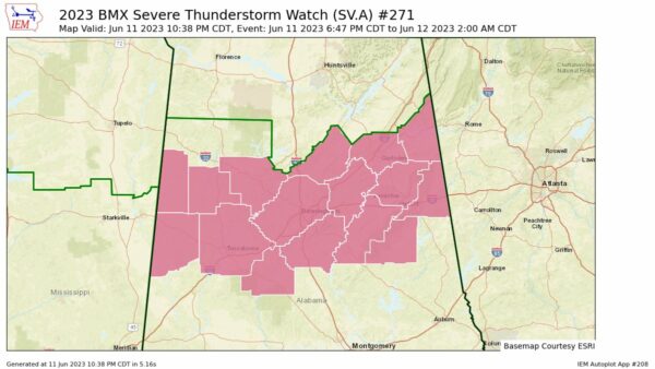
NWS Birmingham has just cleared Marion and Winston counties from the watch. It continues until 2 am for Bibb, Blount, Calhoun, Cherokee, Clay, Cleburne, Etowah, Fayette, Jefferson, Lamar, Pickens, Shelby, St. Clair, Talladega, Tuscaloosa, and Walker counties in Central Alabama.
Category: Alabama's Weather, ALL POSTS, Severe Weather


