
Severe Thunderstorm Watches Have Northwest Alabama Surrounded
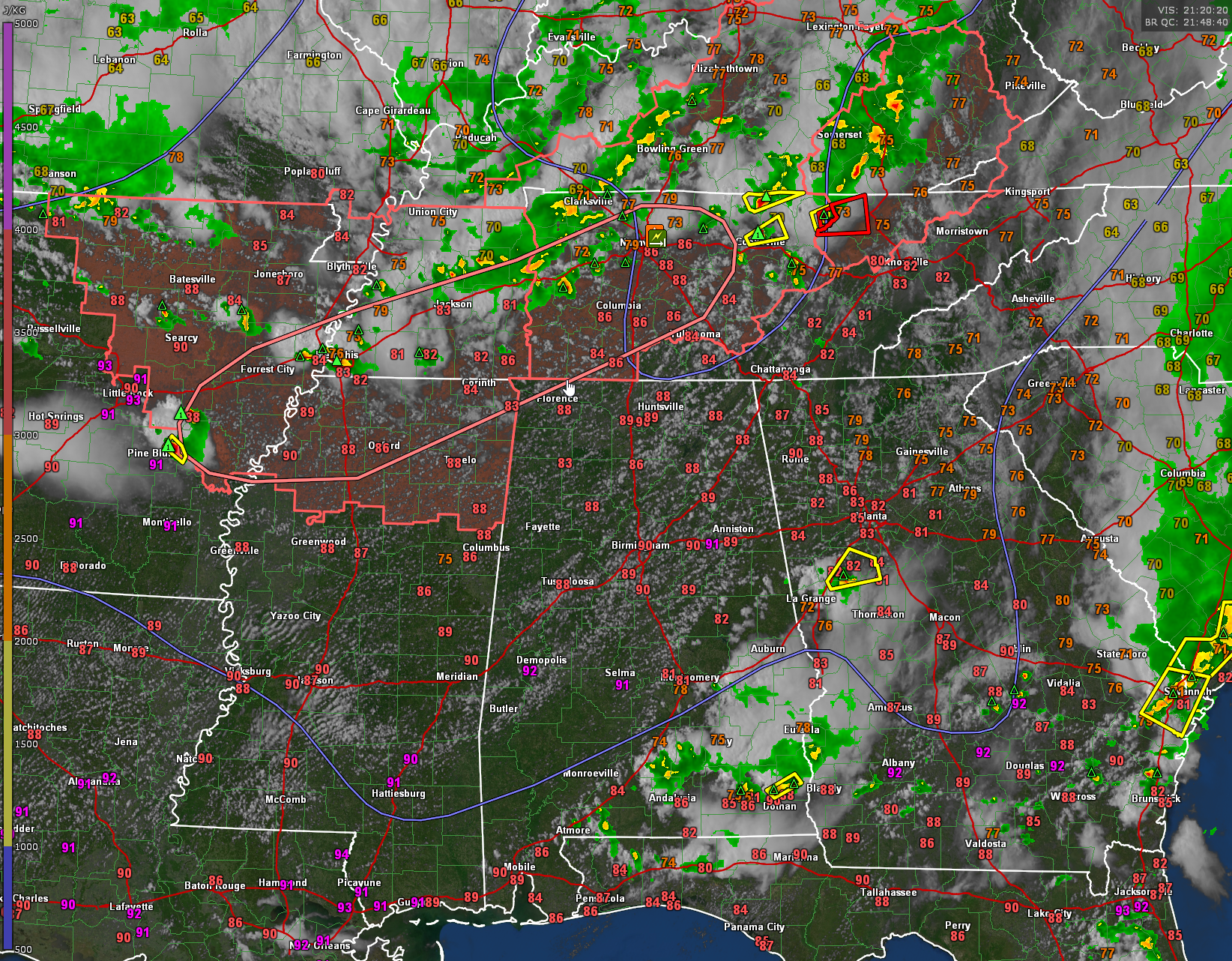
Three severe thunderstorm watches now cover the area from northeastern Arkansas across northern Mississippi, the western two thirds of Tennessee and much of the state of Kentucky.
They are in effect until 10 p.m.
Storms are expected to increase in intensity over the next couple of hours as the storms press southeastward out of the I-40 Corridor between Memphis and Nashville.
There are four severe thunderstorms warnings across the watch areas. There are two tornado warnings in Tennessee near Jamestown and Oneida, northwest of Knoxville.
The SPC just issued a new Mesoscale Discussion:
Mesoscale Discussion 0977
NWS Storm Prediction Center Norman OK
0443 PM CDT Sun Jun 11 2023
Areas affected…portions of eastern AR…northern MS…western to
Middle TN
Concerning…Severe Thunderstorm Watch 265…266…
Valid 112143Z – 112315Z
The severe weather threat for Severe Thunderstorm Watch 265, 266
continues.
SUMMARY…Potential for damaging gusts and large hail is expected to
increase over the next 1-2 hours from parts of eastern Arkansas and
northern Mississippi into western and Middle Tennessee.
DISCUSSION…Mostly discrete cellular convection will continue to
shift east the next few hours. Recent radar trends have shown
increasing intensity in this activity, especially over eastern AR
and western TN, with more modest intensification toward Middle TN.
These storms will continue to shift into moderate to strong
instability over the next few hours. Steep to very steep low-level
lapse rates are in place downstream of this ongoing activity with
MLCAPE values ranging from 1500 J/kg across Middle TN to 3000 J/kg
further west. Vertical shear remains favorable for organized
convection, though is somewhat lower over Middle TN and becomes
stronger with western extent into northern MS. VWP data from NQA
also shows a bit more elongated hodographs compared to the hodograph
at OHX as well, suggesting some better potential for large hail.
Overall this environment should support increasing potential for
large hail and damaging gusts over the next couple hours. With time,
potential exists for some upscale development into bowing clusters
via storm interactions and consolidating outflows.
..Leitman.. 06/11/2023
Category: Alabama's Weather, ALL POSTS, Severe Weather
About the Author (Author Profile)
Bill Murray is the President of The Weather Factory. He is the site's official weather historian and a weekend forecaster. He also anchors the site's severe weather coverage. Bill Murray is the proud holder of National Weather Association Digital Seal #0001 @wxhistorianSubscribe
If you enjoyed this article, subscribe to receive more just like it.


