
FIrst Severe Thunderstorm Warning of the Day: For Parts of Macon County
Storms have been slowly percolating since late morning over Southeast Alabama, mainly south of I-65/I=85.
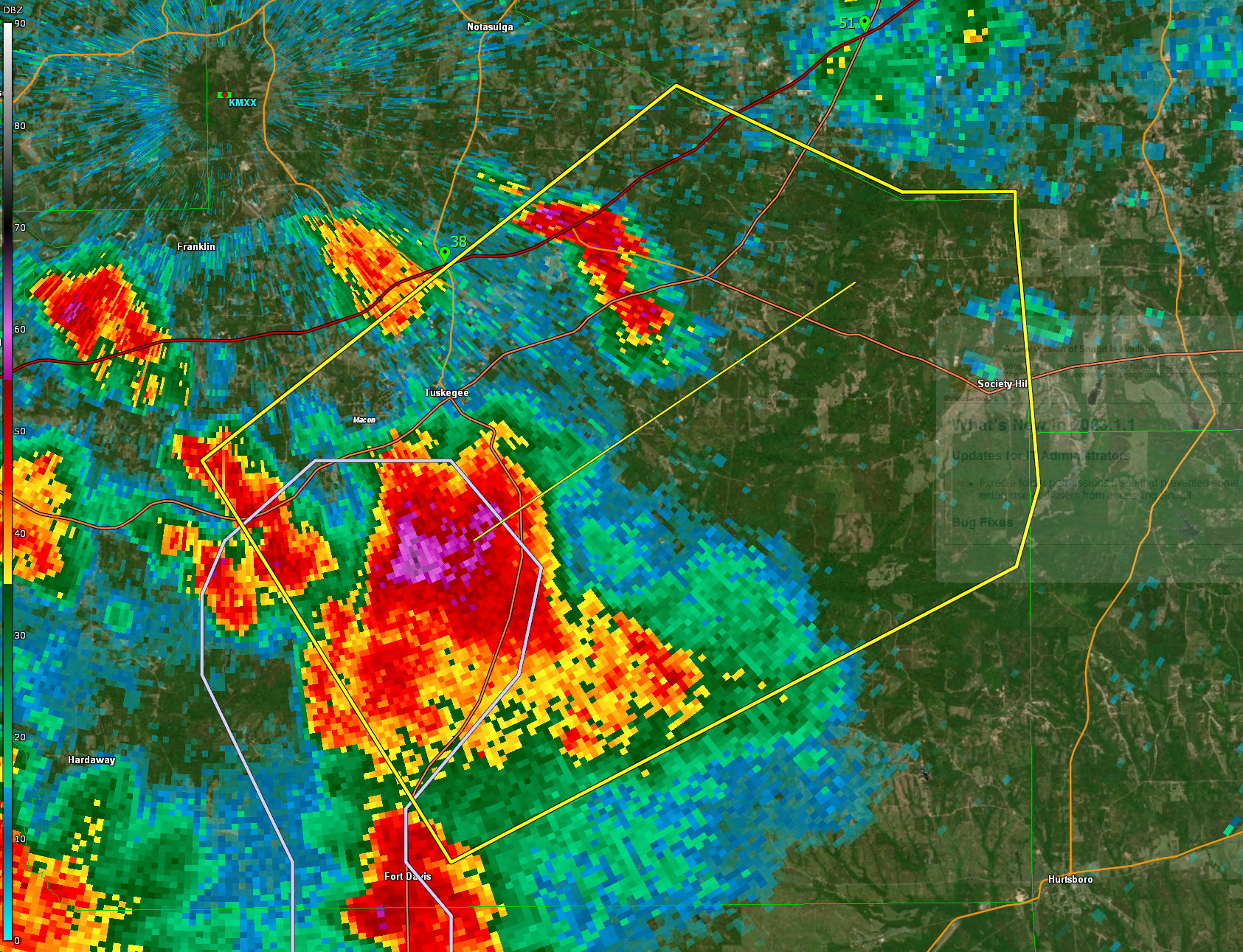
The storms south of Tuskegee has indications of large hail . In fact, there could be isolated golf ball sized hail with it. It is working with plenty of instability with around 2,309 joules of CAPE. It is putting down lots of lighting, around 30 flashes per minute. There is also plenty of precipitable water at 1.8 inches, so heavy rain is likely.
It looks like these storms will continue to strengthen through the afternoon and additional warnings are possible.
More severe weather is likely tonight over the northern half of Alabama as storms which are expected to form over the next few hours to our northwest move into our area.
The National Weather Service in Birmingham has issued a
* Severe Thunderstorm Warning for…
Eastern Macon County in southeastern Alabama…
* Until 230 PM CDT.
* At 203 PM CDT, a severe thunderstorm was located over Davisville,
or near Tuskegee, moving northeast at 25 mph.
HAZARD…60 mph wind gusts and quarter size hail.
SOURCE…Radar indicated.
IMPACT…Hail damage to vehicles is expected. Expect wind damage
to roofs, siding, and trees.
* Locations impacted include…
Tuskegee, Tuskegee National Forest, Davisville, Society Hill, Lake
Tuskegee, Warriorstand, I 85 Rest Area and Moton Field Municipal
Airport.
Category: Alabama's Weather, ALL POSTS, Severe Weather
About the Author (Author Profile)
Bill Murray is the President of The Weather Factory. He is the site's official weather historian and a weekend forecaster. He also anchors the site's severe weather coverage. Bill Murray is the proud holder of National Weather Association Digital Seal #0001 @wxhistorianSubscribe
If you enjoyed this article, subscribe to receive more just like it.


