Midday Nowcast: Looks and Feels Like Summer
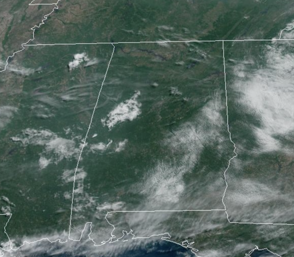
Our weather won’t change much over the next few days with partly sunny days and highs in the upper 80s to lower 90s, which is right around average for this time of year. Each day, during the peak heating of the day, we will have random, widely scattered showers and thunderstorms that form. Many places won’t see a drop, but some communities will experience a heavy storm with potential for small hail and strong gusty winds. The chance of any one specific location seeing a shower or thunderstorm each afternoon through Thursday is in the 20-30% range, and most of the activity will occur from 2-10PM.
ACROSS THE USA: Showers and thunderstorms will persist again into Monday for portions of the Intermountain West and Southern Plain where the rainfall could be locally heavy. Meanwhile, a coastal low in the Gulf of Maine will keep breezy and showery weather across New England with below normal temperatures. Dry and milder weather is in the forecast for the Pacific Northwest through the first half of the week.
FRIDAY AND THE WEEKEND: Drier air will drop into the state Friday and Saturday; on these two days we expect a mostly sunny sky with few, if any showers around. Nights will be a bit cooler, some spots could reach the 50s early Friday and Saturday morning. Then, moisture levels rise on Sunday, and we will bring back the chance of “scattered, mostly afternoon and evening showers and thunderstorms” with a mix of sun and clouds. Highs will remain in the upper 80s and low 90s.
NEXT WEEK: For now we see no real reason to forecast anything but the usual summer forecast for June in Alabama for much of the week. Partly sunny days with the chance of a passing afternoon thunderstorm in scattered spots. Highs will be close to 90 degrees through the week.
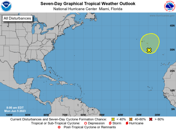
IN THE TROPICS: All is quiet in the Gulf of Mexico, Caribbean Sea, and most of the Atlantic. However, in the Northeastern Atlantic Ocean, disorganized showers and thunderstorms over the northeastern Atlantic Ocean between the Azores and Canary Islands are associated with a complex non-tropical area of low pressure. This system could develop some subtropical characteristics during the next couple of days while it moves little. By late in the week, however, the system is expected to move northeastward over cooler waters ending its chances of subtropical development. For additional information on this system see products issued by the State Meteorological Agency of Spain and High Seas Forecasts issued by Meteo France. Formation chance through 48 hours…low…10 percent. Formation chance through 7 days…low…10 percent. Next name up is Bret.
BEACH FORECAST CENTER: Get the latest weather and rip current forecasts for the beaches from Fort Morgan to Panama City on our Beach Forecast Center page. There, you can select the forecast of the region that you are interested in visiting.
WORLD TEMPERATURE EXTREMES: Over the last 24 hours, the highest observation outside the U.S. was 118.8F at Ahwaz, Iran. The lowest observation was -103.9F Concordia, Antarctica.
CONTIGUOUS TEMPERATURE EXTREMES: Over the last 24 hours, the highest observation was 112F at Death Valley, CA. The lowest observation was 26F at Mount Washington, NH.
Category: Alabama's Weather, ALL POSTS


