The Midday Report — Very Warm & Dry at Midday; Arlene Weakens Into a Depression
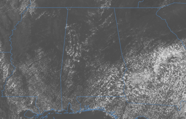
It’s already a warm one out there at the midday hour, with plenty of sunshine and only a few fair-weather clouds dotting the sky across Central Alabama. Temperatures are in the 80s across the area, ranging from as low as 83º in Alexander City, to as warm as 88º in Birmingham, Montgomery, and Selma. Afternoon highs will reach the upper 80s to the mid 90s, with only a very small chance of a few isolated showers and storms developing during the main heating of the day. Tonight looks to be dry with mostly clear skies as lows will only drop into the lower to mid 60s.
A shortwave is still progged to move into the area along with a wedge moving in from the east, which will set the stage for increased scattered shower and thunderstorm chances. Most of the activity will be over the eastern half of Central Alabama, while only a very small chance of a few showers or storms for the west. It will remain hot, with highs in the upper 80s to the lower 90s.
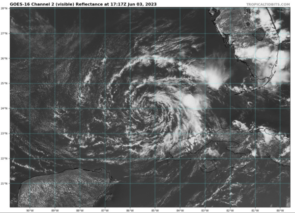
10 AM TROPICAL UPDATE: Arlene has weakened to a tropical depression. The Air Force Hurricane Hunters have been investigating Arlene this morning and found that the minimum pressure has risen to 1000 mb and maximum winds have decreased to 30 kt or less. This weakening trend is due to strong vertical wind shear and dry air that has wrapped into the circulation, and continued weakening is forecast. Deep convection associated with Arlene has been separating from the low-level center, and there are only a few patches of convection left more than 90 n mi northeast of the center. If these trends continue, Arlene will be designated a remnant low later today. The tropical depression is moving south-southeastward at about 6 kt. The system will turn to the east today as it moves within a deep-layer trough, which will likely increase rainfall across portions of southern Florida through tonight.
Category: Alabama's Weather, ALL POSTS, Tropical


