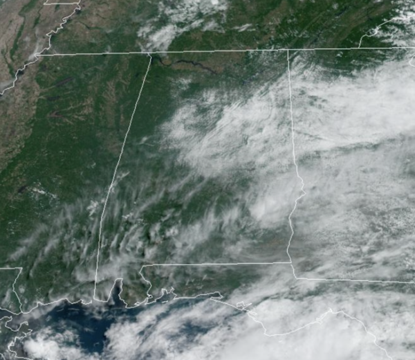
Midday Nowcast: Great Weather for the Final Day of May
Pretty routine weather for this final day of May across Alabama. Afternoon highs are ranging from the low to upper 80s across the state, while a few pop-up afternoon showers and storms are possible, most locations will remain dry.
HELLO JUNE: Partly to mostly sunny weather continues tomorrow and Friday with highs in the mid to upper 80s. Moisture levels continue to rise, meaning it will be more humid, and that will continue to allow for those random, daily showers and storms during the afternoon and evening hours. The chance of any one spot seeing rain will be in the the 20-30% range.
WEEKEND & BEYOND: The weather stays quiet; we expect mostly sunny days, fair nights, and the standard early June chances of rain and storms, around 20% daily; highs will be in the upper 80s and lower 90s. The weather pattern persist into much of next week as well, and it looks like we are entering that hot and humid pattern, which will last well into September.
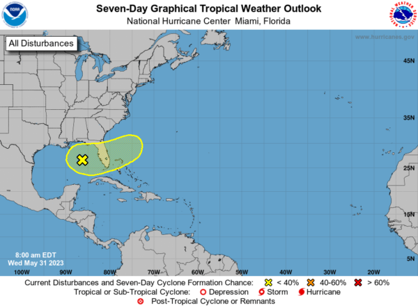
IN THE TROPICS: An area of disorganized showers and thunderstorms is associated with a surface trough of low pressure interacting with an upper-level trough over the eastern Gulf of Mexico. Environmental conditions appear only marginally favorable for additional development over the next several days as the system meanders over the eastern Gulf of Mexico. The system is then forecast to move across the Florida Peninsula this weekend and emerge into the southwestern Atlantic Ocean by early next week. Regardless of development, the system could produce heavy rainfall and gusty winds over portions of the Florida Peninsula later this week and over the weekend. Formation chance through 48 hours…low…10 percent. Formation chance through 7 days…low…20 percent.
Hurricane season officially begins tomorrow, June 1st and last though November 30th. Here is the list of names for this year: Arlene, Bret, Cindy, Don, Emily, Franklin, Gert, Harold, Idalia, Jose, Katia, Lee, Margot, Nigel, Ophelia, Philippe, Rina, Sean, Tammy, Vince, and Whitney.
BEACH FORECAST CENTER: Get the latest weather and rip current forecasts for the beaches from Fort Morgan to Panama City on our Beach Forecast Center page. There, you can select the forecast of the region that you are interested in visiting.
WORLD TEMPERATURE EXTREMES: Over the last 24 hours, the highest observation outside the U.S. was 116.6F at Matam, Senegal. The lowest observation was -105.7F Vostok, Antarctica.
CONTIGUOUS TEMPERATURE EXTREMES: Over the last 24 hours, the highest observation was 106F at Rio Grande Village, TX. The lowest observation was 26F at Peter Sinks, UT.
Category: Alabama's Weather, ALL POSTS


