Quiet Pattern For Alabama Through Memorial Day
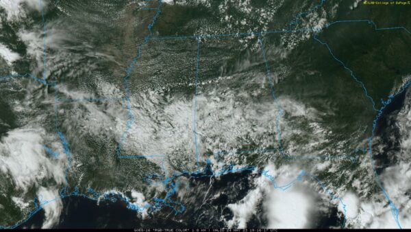
RADAR CHECK: While most of Alabama is dry this afternoon, we do note a few small spotty showers over the southern 2/3 of the state. Otherwise, we have a mix of sun and clouds with temperatures mostly in the 77-82 degree range. Those isolated showers will end this evening, and tonight will be mostly fair with a low not too far from 60 degrees.
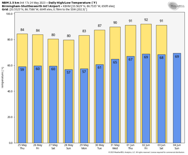
A significant push of dry air arrives tomorrow; the sky will be mostly sunny with a high in the mid 80s.
FRIDAY AND THE HOLIDAY WEEKEND: The weather still looks favorable Friday through Monday across Alabama with generally dry conditions and below average temperatures. A surface low will form east of the state, and showers are likely across Georgia and the Carolinas; for now we will mention only isolated showers each day for Alabama, mostly during the afternoon and evening hours. The chance of any one spot getting wet daily is 15-20 percent. Otherwise, expect partly to mostly sunny days and fair nights. The high Friday will be close to 80, followed by mid to upper 70s Saturday and Sunday. Monday’s high will be in the low 80s for Memorial Day.
REST OF NEXT WEEK: The weather looks fairly quiet with just a few widely scattered showers and storms around each day. Heat levels will be rising, and afternoon temperatures will likely reach 90 degrees over the latter half of the week. See the video briefing for maps, graphics, and more details.
TROPICS: A non-tropical area of low pressure is expected to form along a front offshore of the southeastern United States coast during the next day or two. The system appears unlikely to become a subtropical or tropical cyclone since it is forecast to remain frontal while moving generally northward and inland over the Carolinas this weekend.
Regardless, the system is likely to produce gusty winds and dangerous surf and rip current conditions along portions of the southeastern United States coast late this week and into the weekend. Heavy rainfall is expected in portions of the Carolinas, and hazardous marine conditions are expected over the coastal and offshore waters where gale watches and warnings are in effect.
The rest of the Atlantic basin is quiet.
ON THIS DATE IN 1973: An F4 tornado tore through the small town of Union City, Oklahoma, killing two and injuring four others. This tornado was the first storm to be studied in detail by the National Severe Storms Laboratory Doppler Radar Unit at Norman, OK and an armada of researchers in the field. Research of the radar data from the storm would lead to the discovery of a “TVS,” or Tornado Vortex Signature.
Look for the next video update here by 6:00 a.m. tomorrow…
Category: Alabama's Weather, ALL POSTS, Weather Xtreme Videos


