Sunday Brunch Weather Update: Clouds Thickening, Rain Returns Monday
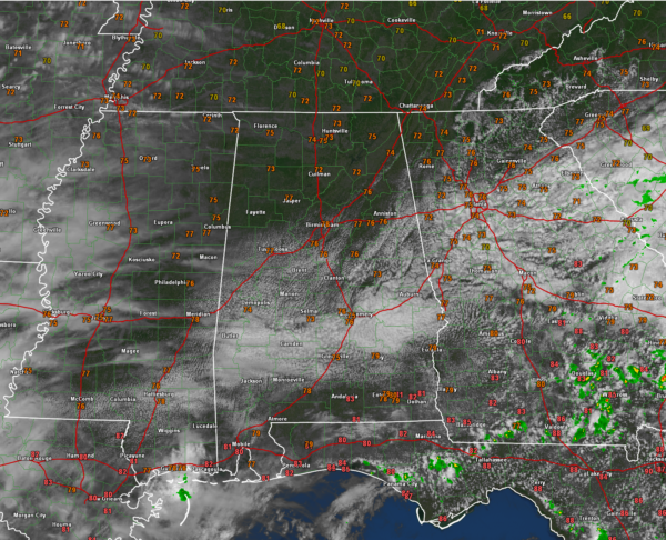
It has been a tale of two skies across Alabama on this May Sunday. The southern half of the area has seen considerable cloudiness all morning as a developing low pressure system over southern Georgia is spreading moisture back into Alabama from the east. That area of clouds is slowly building northward and partly cloudy skies have reached the southern part of the Birmingham Metro.
Meanwhile, higher clouds are spreading eastward across Mississippi from increasing upper level moisture to our west.
Skies will become mostly cloudy by tonight. There could be a few light showers working their way back into eastern Alabama from Georgia, but they will be isolated and short lived.
An easterly wedge will set up on Monday pushing a back door cold front into Alabama from the east. Showers and storms will develop during the morning and affect the area through Monday night.
Meanwhile, an upper low approaching from the west will keep the rain chances going into Tuesday. Temperatures on Monday will be held down by the increased clouds and rain, with highs remaining in the 70s. Tuesday will see highs even a few degrees colder than those of Monday. Look for warmer temperatures come Wednesday. 80s will be prevalent the remainder of the week into week two. Look for 90s by the first of June as we get an early preview of summer.
Category: Alabama's Weather, ALL POSTS


