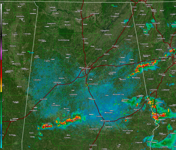
Cold Front Pushing Southeast
Our cold front now bisects southwest to northeast Alabama across the middle of the state south of Clanton.
The storms of the afternoon were only able to muster one severe thunderstorm warning, for parts of Barbour County, just before 7 p.m.
Tonight, storms extend across Marengo County near Linden, and extending east northeastward through northern Dallas County to Selma. Other storms are in East Central Alabama from Dade3ville over to Valley and down to Phenix City.
Elsewhere, a line of storms extends from northeast of Ashland across Clay and Randolph Counties to near Carrollton in Georgia.
The storms will slowly weaken through the remainder of the night as instability levels slowly wane. The storms will be completely gone shortly after midnight.
Tomorrow will feature a good supply of sunshine with highs ranging between 78-84F.
Working on a forecast update and preparing for the briefing video. Will continue to monitor the storms till they are out of Central Alabama. Have a great night.
Category: ALL POSTS


