Isolated to Scattered Thunderstorms May Produce Sporadic Damaging Winds Through the Afternoon
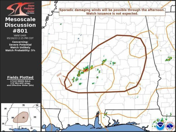
SPC has just released a Mesoscale Discussion covering a large part of Central Alabama, stating that a few storms could produce gusty winds through the afternoon. A severe thunderstorm watch is not expected at this point, but a few severe thunderstorm warnings are possible. Here is the text of the discussion:
SUMMARY… Isolated to scattered thunderstorms may produce sporadic damaging winds through the afternoon across eastern Mississippi into western and central Alabama. Watch issuance is not expected.
DISCUSSION… Over the past hour, isolated thunderstorms have developed within a pocket of warm (mid 80s) surface temperatures where low-level parcels are reaching their convective temperatures and inhibition is negligible. Recent RAP analyses estimate MLCAPE values are approaching 1500 J/kg over eastern MS/western AL, but deep-layer shear appears very limited given 20-25 knots of flow in the 6-8 km layer. Consequently, storm modes will remain fairly disorganized as convection migrates east/northeast towards western and central AL though the afternoon. However, continued daytime heating will allow dewpoint depressions to climb to 15-20 F with PWAT values on the order of 1.75 inches. These thermodynamic characteristics should be conducive for wet downbursts capable of sporadic damaging winds, and perhaps marginally severe hail with the more intense updraft pulses. Latest runs of the HRRR support this idea with a transient signal for 40-45 knot gusts over east MS/AL this afternoon. Given the localized and transient nature of the threat, watch issuance is not expected.
Category: Alabama's Weather, ALL POSTS, Severe Weather


