Midday Nowcast: Hot and Humid Monday Afternoon
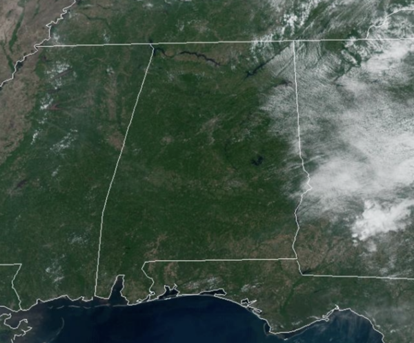
REST OF TODAY: It is hot and humid Monday afternoon with plenty of sunshine today as afternoon highs surge into the upper 80s to lower 90s. Add in the humidity, and those heat index will make it feel more like the mid-90s for many locations. A few heat-relieving pop-up afternoons storms will be on the radar this afternoon, but the vast majority of Alabama will remain dry today.
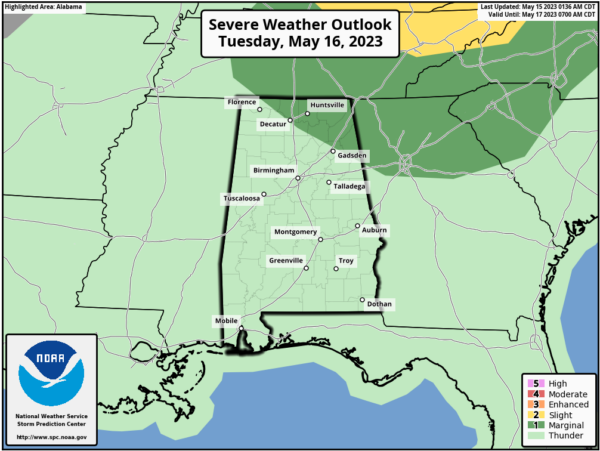
INCREASING STORMS TOMORROW: Rain chances increase tomorrow as the coverage of showers and thunderstorms will be higher ahead of a surface front dropping south into the state. The SPC has the northeast corner of the state in a “marginal risk” (level 1/5) of severe storms.
Stronger storms tomorrow across Northeast Alabama could produce hail and strong winds; tornado threat is near zero. For the rest of the state, tomorrow will feature more clouds than sun, with scattered to numerous showers and storms. It will be another very warm and muggy day with highs in the mid to upper 80s.
REST OF WEEK: The front sinks down into South Alabama for the latter half of the week, meaning our heat levels come down as highs will drop into the lower 80s and humidity levels will be lower. The highest coverage of showers and storms will shift into South Alabama along the frontal boundary. Any rain across the northern half of the state will be widely spaced and fairly isolated.
WEEKEND WEATHER: Wet weather highlights the first half of the weekend as another front drops into the state allowing for rain and storms Saturday. Sunday will be an incredible day of weather as a dry, continental airmass with lower humidity and a sunny sky settle into the state. Highs will remain close to 80°, which is a bit below average for mid to late May in Alabama. The dry weather will continue into the first half of next week; a few scattered showers could return by Thursday and Friday. Highs will be generally in the 80s, with lows in the 60s. Enjoy, because it won’t be long when 90s will become more and common in the forecast.
BEACH FORECAST CENTER: Get the latest weather and rip current forecasts for the beaches from Fort Morgan to Panama City on our Beach Forecast Center page. There, you can select the forecast of the region that you are interested in visiting.
WORLD TEMPERATURE EXTREMES: Over the last 24 hours, the highest observation outside the U.S. was 115.5F at Ibri, Oman. The lowest observation was -102.6F Vostok, Antarctica.
CONTIGUOUS TEMPERATURE EXTREMES: Over the last 24 hours, the highest observation was 106F at Death Valley, CA. The lowest observation was 22F at Roscommon, MI.
Category: Alabama's Weather, ALL POSTS


