Showers Return To Alabama Today; Summer-Like Temperatures On The Way
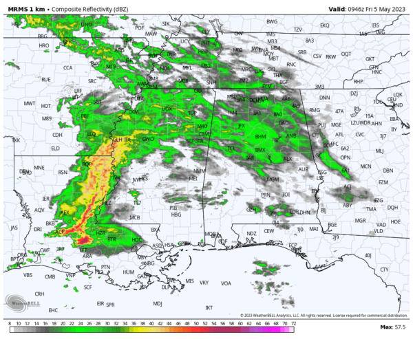
RADAR CHECK: Rain has returned to much of North and Central Alabama early this morning ahead of a northward moving warm front. There will be periods of rain this morning, followed by another chance of widely scattered showers or storms this afternoon and this evening. The most widespread rain today will come during the morning hours; otherwise today will be mostly cloudy with highs ranging from the upper 60s across the northern third of the state to the mid 80s for South Alabama.
A strong storm is possible across the southwest corner of the state today, where SPC has defined a low end “marginal risk” (level 1/5) of severe thunderstorms.
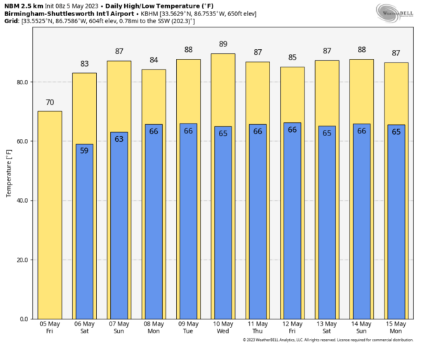
The weekend will be warm and humid with a mix of sun and clouds tomorrow and Sunday. There will a risk of widely scattered showers and thunderstorms both days, especially during the afternoon and evening hours (much like a summer day). But, much of the weekend will be dry. Most communities across the state will see highs at or over 80 degrees both days as a summer-like pattern sets in. The chance of any one spot seeing rain both days is 25-35 percent, and most of the showers (but not necessarily all of them) will come from 1:00 until 8:00 p.m.
NEXT WEEK: Summer-like weather continues with warm, humid days along with highs in the 80s. Some spots could approach the 90 degree mark by mid-week. A few scattered, mostly afternoon and evening showers and thunderstorms are possible on a daily basis… looks like the highest coverage of showers will come Monday and Tuesday, followed by a trend toward drier weather over the latter half of the week. See the video briefing for maps, graphics, and more details.
ON THIS DATE IN 1933: An estimated F4 tornado moved from near Brent and Centreville to Helena during the pre-dawn hours. It killed 14 and injured 150 while demolishing more than 100 buildings. Much of the town of Helena was destroyed. Another tornado the same day killed four people at Demopolis.
ON THIS DATE IN 1995: A supercell thunderstorms brought torrential rains and large hail up to four inches in diameter to Fort Worth, Texas. This storm also struck a local outdoor festival known as the Fort Worth Mayfest. At the time the storm was the costliest hailstorm in the history of the US, causing more than $2 billion in damage.
Look for the next video briefing here by 3:00 this afternoon… enjoy the day!
Category: Alabama's Weather, ALL POSTS, Weather Xtreme Videos


