Still Dry Across Alabama Today; A Few Showers Tomorrow
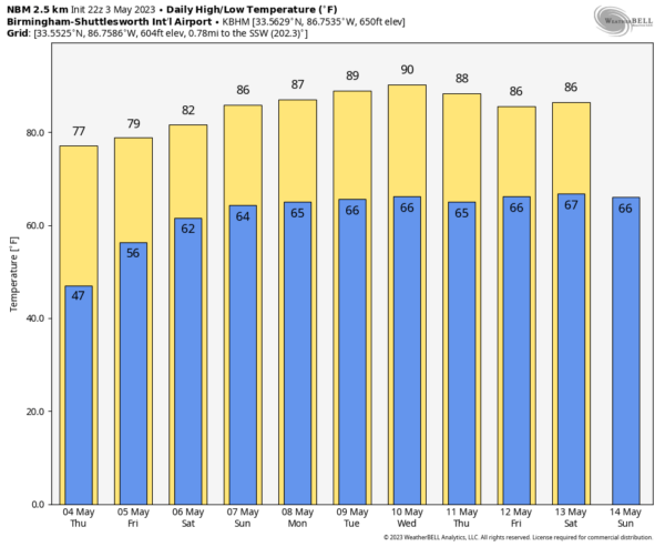
STILL DRY TODAY: Temperatures are mostly in the 40s across Alabama early this morning; we expect a high in the 76-82 degree range today with a sunny sky. Clouds will increase tonight, and a few showers are possible as early as tomorrow morning as a warm front approaches from the south. Additional scattered showers or storms are possible tomorrow afternoon/evening, especially across the Tennessee Valley region of North Alabama. Still, a decent part of the day tomorrow will be dry with a high in the mid to upper 70s.
THE WEEKEND: We are forecasting a mix of sun and clouds Saturday and Sunday with highs generally in the low 80s. Humidity levels will be higher, and we will mention some risk of scattered showers and storms both days. But, the odds of any one spot getting wet are only around 35 percent Saturday, and 20 percent Sunday. So the weekend certainly won’t be a wash-out. Highest chance of a passing shower both days will come during the afternoon and evening hours.
NEXT WEEK: The week will be much like summer with warm, humid days and some risk of scattered showers or storms on a daily basis. The latest global model data suggests the highest coverage of showers could come early in the week Monday and Tuesday, with a trend toward drier weather across the latter half of the week as ridging builds. Highs will be well in the 80s, and some spots could touch 90 degrees by mid-week. See the video briefing for maps, graphics, and more details.
ON THIS DATE IN 2003: The week of May 4th through the 10th was one of the busiest weeks for tornadoes in U.S. history. On this date through the 5th, the deadliest outbreak of severe weather since May 1999 produced 84 tornadoes, large hail and damaging winds across eight states. Several thunderstorms became tornadic with a total of five distinct tornado touchdowns in the Kansas City metropolitan area. Two of the tornadoes received a rating of F4, two a rating of F2, and the last was rated an F1.
ON THIS DATE IN 2007: A devastating EF5 tornado demolishes nearly every structure in Greensburg, Kansas around 9:30 pm (CDT) and kills ten. The mammoth wedge tornado cuts a swath 1.7 miles wide and 22 miles long across the Kansas landscape. It is the worst single tornado to touch down in the U.S. in eight years.
Look for the next video briefing here by 3:00 this afternoon… enjoy the day!
Category: Alabama's Weather, ALL POSTS, Weather Xtreme Videos


