End of The Afternoon Report: Action Beginning to Pick Up to Our West
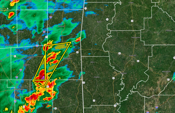
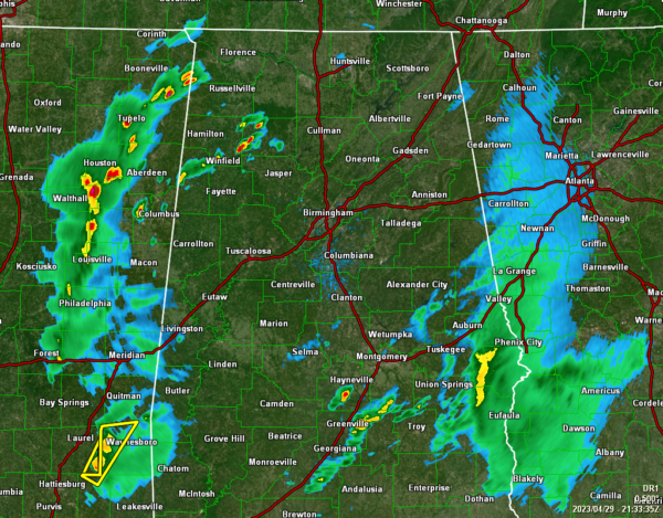
While much of the rest of the activity in Mississippi remains well-behaved at the moment, a Severe Thunderstorm Warning has been issued for Perry and Wayne counties in southeastern Mississippi until 5:15 pm. At 4:27 pm, a severe thunderstorm was located near Ovett, or 9 miles north of Richton, moving northeast at 40 mph. The main threat with this storm is quarter size hail.
As for the state of Alabama, we have showers moving slowly over the northwest portions, along with rain just to the south and east of Montgomery. Some of this rain is heavy, but no gusty winds or hail are being reported.
FOR THE REST OF YOUR SATURDAY
North Alabama: The short wave in the southern parts of the state will lift northeastward into central Georgia tonight, and while there will be some instability present in the atmosphere, only a limited amount of thunder will be possible.
Central Alabama: While the SPC graphic still shows much of the southern-third of the state remaining in a Marginal Risk for the rest of today, the risk for the extreme southeastern counties have ended for this event. The focus will shift mainly from southern Pickens County to southern Montgomery County and south. There will be a lower-end hail and isolated damaging wind threat through the evening hours.
South Alabama: While storms have been slower to develop this afternoon, we are now starting to see the development and strengthening occurring. Unfortunately, there have been some back building in these storms, so there may be a slightly higher threat of localized flooding compared to the threat of severe storms. A Marginal Risk continues for all of South Alabama.
Category: Alabama's Weather, ALL POSTS, Severe Weather


