Mid-Afternoon Weather Update for Across the State
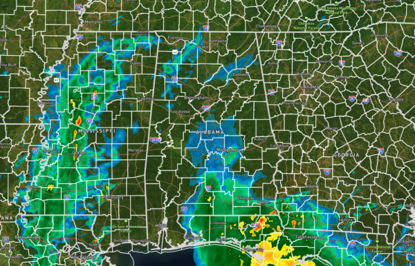
For North/Central Alabama… A few showers have developed ahead of the main activity up in the northwestern and north-central parts of the area. These are rather light at the moment and will be affecting the cities of Athens, Decatur, Moulton, and Haleyville. However, a good cluster of rain and storms have developed over west and west-central Mississippi and is slowly making its way toward us. Also, some rain will move up into the southeastern parts of the area from the southwest as a surface low continues to move across the northern Gulf of Mexico. A few storms may become strong to isolated severe through the afternoon and evening hours over the southern portions of the area, with gusty winds and hail being the main threats. There is a non-zero tornado threat as well. The rest of the rain showing up on radar is actually a false-return, and no precipitation is falling in those regions.
Down in South Alabama and the Gulf Coast… Showers and thunderstorms will continue to move east across the western Florida Panhandle and begin to diminish from west to east over the next few hours. Back to the west, skies will begin clearing and will allow for the atmosphere to begin to destabilize once again. Some additional showers and thunderstorms will form later this afternoon and move east, with the potential for a few strong to severe storms through the evening hours. If enough instability is able to develop, then isolated damaging winds and large hail will be possible.
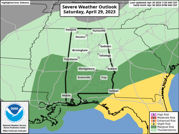
The Storm Prediction Center has a Marginal Risk up for locations along and south of a line from Aliceville to Prattville to Smiths Station. The main window for this strong to severe weather threat will be from now until 8 pm this evening from west to east. Isolated damaging wind gusts up to 60 mph and quarter size hail will be possible, but we also can’t rule out a brief tornado.
Category: Alabama's Weather, ALL POSTS, Severe Weather


