The Midday Report: Another Nice, Warm, & Sunny Day
REMAINDER OF THIS WEEK
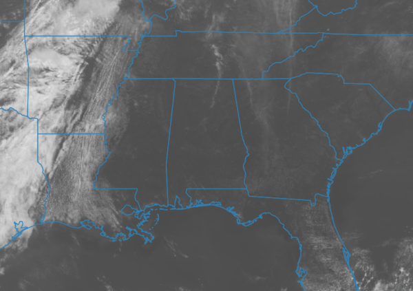
As of the 11 am roundup, skies were mainly sunny across all of Central Alabama, with temperatures up in the mid 70s to the lower 80s. Troy was the warm spot at 80º. Gadsden and Prattville were the cool spots at 75º. Birmingham was at 78º. We’ll continue to have mainly sunny skies through the afternoon, with highs ranging in the mid to upper 80s. Clouds will begin to increase this evening and tonight, but we’ll remain dry. Lows will be in the mid to upper 50s.
A cold front will move into the area late in the day on Friday that will bring a chance of showers and storms during the afternoon, with rain and storms becoming likely during the evening and overnight hours. The good news is that the rain and storms will be out of the area right at or just after sunrise on Saturday. No severe weather is expected. Highs in the mid 70s to the mid 80s.
THIS WEEKEND
Skies will clear out from west to east throughout the day on Saturday, with highs topping out in the 70s across the area. Sunshine returns in full force on Sunday, as highs will be in the mid 60s to the upper 70s. Should be no issues at Talladega for race weekend, or down in Tuscaloosa for the A-Day game.
THE 1ST PART OF NEXT WEEK
The start to next week will be sunny and dry on Monday, with highs in the mid 60s to the mid 70s. After that, there will be a chance of showers on each day through the rest of the week. Tuesday’s highs in the upper 60s to the upper 70s. Wednesday’s highs in the 70s.
ON THIS DAY IN WEATHER HISTORY
1920 – Tornadoes in Mississippi and Alabama killed 219 persons.
Category: Alabama's Weather, ALL POSTS


