Strong Storms Across Central Alabama
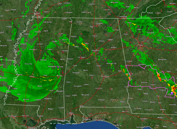
The center of the vigorous low-pressure center is near Philadelphia MS this afternoon.
A band of showers and storms extends from the northern side of the low back across East Central Mississippi and Central Alabama. It extends from near Eupora MS to near AQmory MS through parts of Lamar, Fayette, Walker, Jefferson, Shelby, Talladega, Coosa, Tallapoosa, Lee, and Russell Counties.
The strongest storms in Alabama are in Walker Counties and Jefferson Counties east of Fayette, and west of Birmingham. Other strong storms are moving into Auburn from the southeast and southwest of Phenix City.
None of the storms are severe in Alabama or Mississippi, but they are ramping up. They do have lightning and gusty winds. They are low-topped so hail is not a problem. We will be monitoring these storms to see if they can become severe. They are in the Marginal Risk (1/5) area from the SPC. The storms in East Central Alabama between Alex City, Clanton, Auburn and Eufaula are in the SPC’s Slight Risk (2/5) area.
Continue to be alert for possible severe thunderstorm and even an outside risk of a tornado warning along this band of storms as it lifts northward.
The storms along a separate feeder band in Georgia have been more problematic. A funnel cloud was reported west of Alma at 2:11 p.m. CDT and a confirmed tornado was reported east of Cordele at 1:44 p.m. CDT.
A tornado watch continues for several counties in South Georgia along that more eastern feeder band.
Category: Alabama's Weather, ALL POSTS


