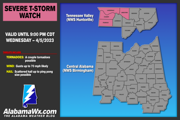
Severe Thunderstorm Watch Issued for Northwest Alabama
A line of storms extends from western Ohio through Central Indiana, to near Evansville IN, and Paducah KY, then to near Memphis TN, and Greenville MS, and on through Louisiana and southeastern Texas.
The storms are out ahead of a strong cold front that is pushing steadily southeastward. Readings fall into the 60s and 50s pretty soon after the front arrives. Ahead of the front, they have risen well into the 80s.
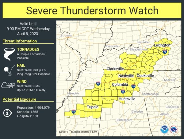
The SPC has issued a Severe Thunderstorm Watch for western Kentucky, western Tennessee, Northeast Mississippi, and Northwest Alabama. It is valid until 9 p.m.
Even though it is a Severe Thunderstorm Watch, a couple of tornadoes are possible in the watch area.
The storms should continue to intensify as they push eastward and afternoon heating continues. Temperatures are in the upper 70s to middle 80s ahead of the line, and dewpoints are in the middle and upper 60s, plenty high enough for severe weather of course.
Over Northwest Alabama, instability values are in the 1500 joules/kg range. Bulk, or speed wind shear, is around 40-50 knots. These are sufficient for severe storms to form ahead of the main line. Overall low level helicity is low though, less than 100 m2/s2, but discrete cells that form could pose a tornado threat. And spin up tornadoes are very possible in the squall line. Damaging winds are the main threat. And there could be some large hail.
Storms will reach Northwest Alabama around 6-7 p.m. with another line coming through after midnight tonight.
Thunderstorms will push slowly eastward through the night and will still be affecting Central Alabama tomorrow. Some of these storms could be strong to severe tomorrow afternoon. The SPC doesn’t have a risk posted for Central Alabama for tomorrow, but that could be a possibility.
Category: Alabama's Weather, ALL POSTS, Severe Weather


