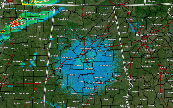
A Quick Weather Check Just Before Midnight
As of 11:45 pm, it is still quiet across North/Central Alabama, even with a Tornado Watch in effect for Colbert, Franklin, and Lauderdale counties in the northwestern parts of the state. However, low-level moisture and shear have increased over the area during the night so far.
NWS Birmingham and NWS Huntsville is currently in coordination talks with the Storm Prediction Center for a new tornado watch to be issued within the next 60 minutes.
Surface-based instability is increasing over the western half of the area and will continue to increase as the cold front and line of storms continue to move eastward. With the combination of increasing helicity and wind shear, the threat of rotating updrafts will be possible, which will lead to the potential of tornadoes and severe thunderstorm development.
Timing continues to show the storms not arriving in the northwest corner of the state until after midnight, with the threat persisting from northwest to southeast until 12 pm on Saturday.
Category: Alabama's Weather, ALL POSTS, Severe Weather


