

Focusing on Western Tennessee and Northern Mississippi
Two dangerous storms for Western Tennessee and Northern Mississippi at this hour.
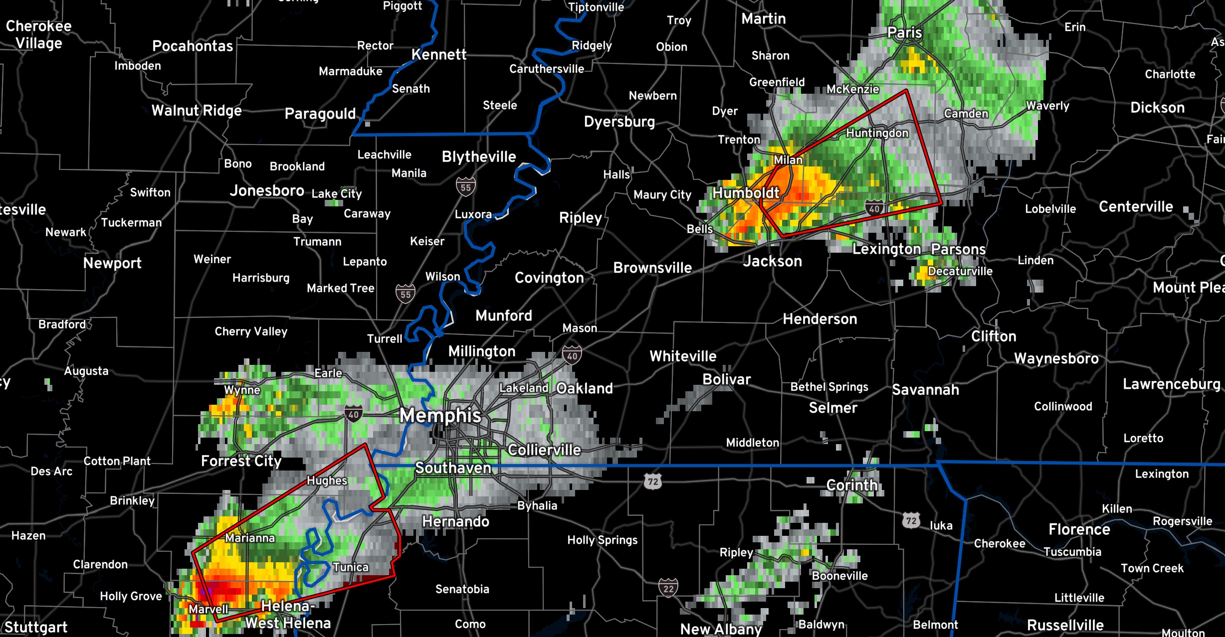
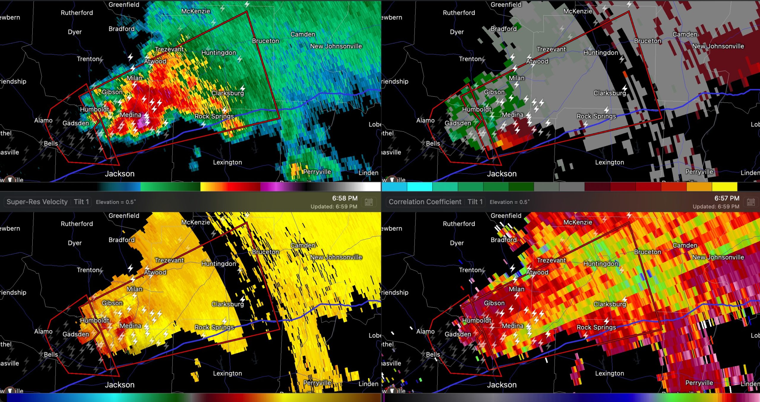
One is passing north of Jackson TN. It is just north of I-40 and is heading toward Medina and Three Way. Chasers indicate it is getting ready to become tornadic again. It is in an area of powerful shear, some of the strongest you will see, with helicities in the 0-1km layer around 550-650 m2s2. The good news is that it is gradually moving into lower instability and will hopefully weaken with time. The Convection Allowing Models have been indicating that today and that would be great if it were to come true.
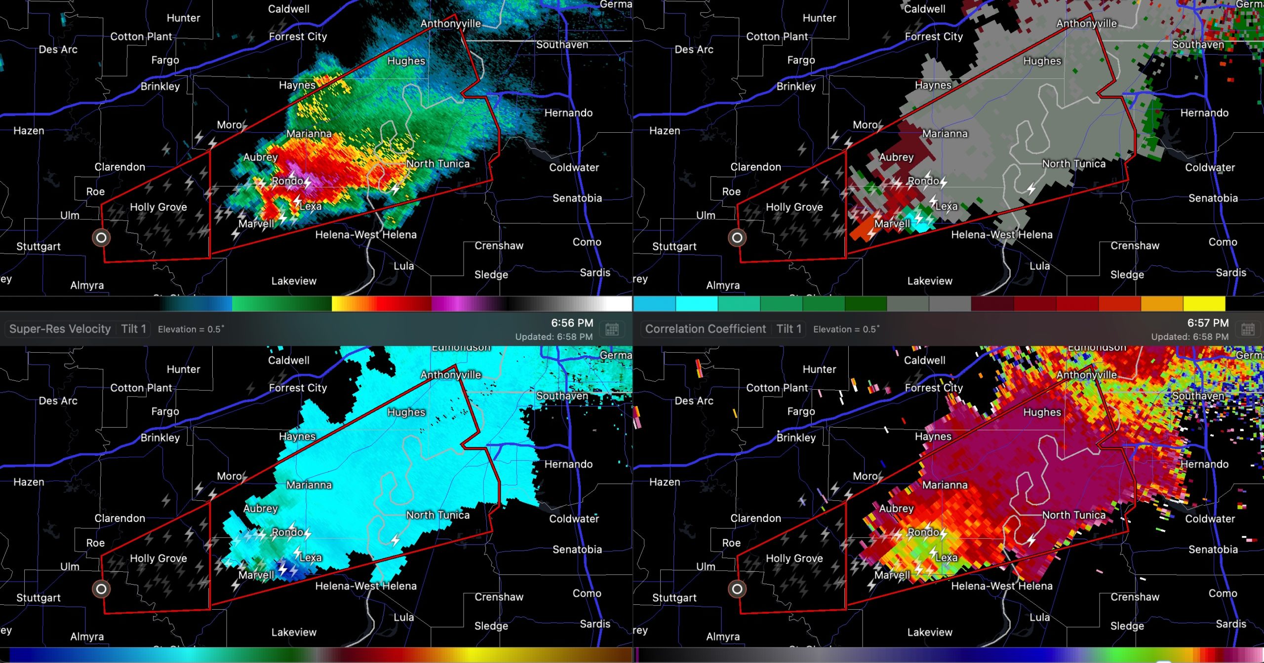
But another dangerous storm is in the better instability in extreme eastern Arkansas near Rondo. This storm will be approaching the Mississippi River shortly south of Memphis. It appears to be turning to the right and could impact areas from Henderson Lake down to Tunica. Robisonville and Hollywood are in the path as well. Of course, there are big casinos at Tunica. This storm could eventually affect places like Horn Lake, Southaven, Olive Branch, and Germantown.
Category: Alabama's Weather, ALL POSTS, Severe Weather
About the Author (Author Profile)
Bill Murray is the President of The Weather Factory. He is the site's official weather historian and a weekend forecaster. He also anchors the site's severe weather coverage. Bill Murray is the proud holder of National Weather Association Digital Seal #0001 @wxhistorianSubscribe
If you enjoyed this article, subscribe to receive more just like it.


