Breaking News: Strong Storms Possible Overnight
A little change in our thinking tonight.
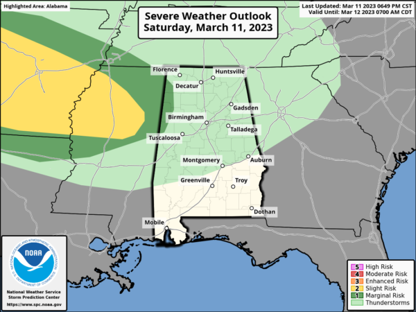
Thunderstorms are occurring tonight over southeastern Arkansas and northwestern Mississippi. Those storms are not surface-based, but rather what we called “elevated” storms. That doesn’t mean they are stronger, but that their bases are “elevated” or higher in the atmosphere.
Those elevated storms can produce hail and strong winds, but generally don’t produce tornadoes.
The storms do have plenty of speed shear to work with, and the stronger ones will show enough organization to potentially approach severe limits overnight. They could produce strong gusty winds and even some hail. There could be a couple of severe thunderstorm warnings which should be taken seriously, like all severe thunderstorm warnings. But they definitely will produce lightning and loud, crashing thunder
They will reach Northwest Alabama between midnight and 2 a.m.
They will reach Tuscaloosa and Birmingham between 5 and 6 a.m.
They will reach the I-65 Corridor around 9 a.m.
Meanwhile, a mesoscale convective complex appears to be developing over western Arkansas. These storms will push southeastward into Central Mississippi after 5 a.m. They will reach SouthWest Alabama around 10 a.m. but will affect areas from Butler in Choctaw County southeastward to near Evergreen in Conecuh County down to the Mobile area.
The strongest storm in Alabama may occur after 4 p.m. across South Alabama into the Florida Panhandle. It remains to be seen if any strong storms can form closer to the front across Central Alabama during the afternoon.
I am updating the forecast now and Scott will be on after midnight to track the storms. I will be back at 5 a.m. for tracking and the video.
Category: Alabama's Weather, ALL POSTS, Severe Weather


