Mid-Saturday Afternoon Weather Check
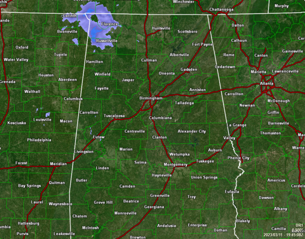
At 1:54 pm, we are starting to see some moisture work into the northwestern parts of the state, as light showers are falling over portions of Lauderdale, Colbert, and Franklin counties in the Tennessee Valley. For now, the rest of North/Central Alabama is dry with the skies filling up with clouds over the western half, while it’s partly to mostly sunny east of I-65. The 1 pm roundup showed temperatures in the upper 50s to the lower 70s across Central Alabama. Troy was the warm spot at 71º. Gadsden was the cool spot at 59º. Birmingham was at 63º. Afternoon highs will top out in the lower 60s to the lower 70s.
Showers will continue to move in from the west and northwest and eventually most of us will see showers north of I-85 during the late-night and overnight hours as a cold front will be moving in our direction. The highest rain chances will be along and north of I-20, and some of those locations may even here some thunder. Lows will dip down into the lower 50s to the lower 60s.
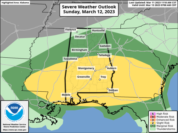
So far, not much change in the thinking on tomorrow’s severe weather threat across North/Central Alabama. The SPC risk definitions remain the same from this morning, as a Slight Risk is up for locations along and south of a line from just north of Geiger to Alabaster to just north of Wedowee. Nearly the rest of the area remains in a Marginal Risk for severe storms. The primary threats will be damaging winds and hail, but a brief tornado or two simply cannot be ruled out completely. While rain and storms will be going during the morning hours, timing for the threat of severe storms will be from 12 pm in the northwest and coming to an end around 7 pm in the southeast. Once the threat ends, rain and non-severe storms may continue for a few hours longer. Highs will top out in the lower60s to the mid 70s.
Category: Alabama's Weather, ALL POSTS, Severe Weather


