Beautiful Weekend Ahead
**No afternoon video briefing today**
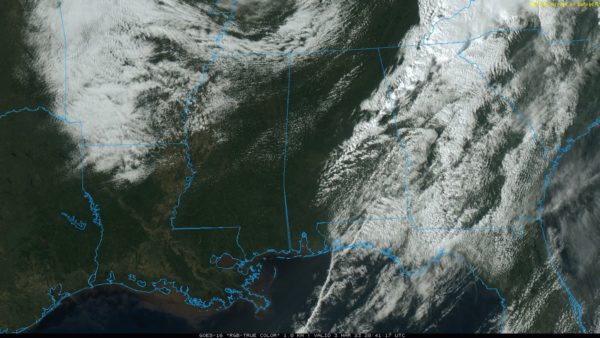
SEVERE WEATHER THREAT IS OVER: The line of severe storms that produced widespread tree and power line damage over the northern half of Alabama this morning has moved into Georgia, and the lingering line of showers over the eastern counties will be out of the state soon. Most communities are enjoying a sunny, windy afternoon with temperatures in the 70s. Tonight will be clear with a low in the 40s.
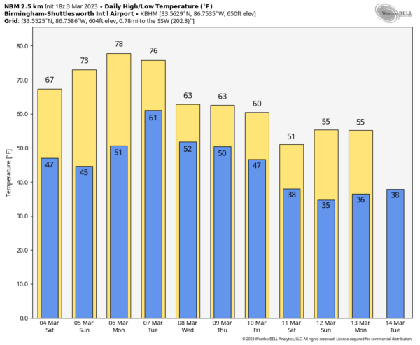
THE ALABAMA WEEKEND: The weekend will feature will pleasant days and clear cool nights. The high tomorrow will be in the 65-75 degree range, followed by 70s Sunday. Lows will be mostly in the 40s, but colder pockets across North Alabama could reach the 30s early Sunday morning.
NEXT WEEK: Model consistency remains poor concerning weather next week. We will mention a chance of scattered showers during the mid-week period, but it could be Friday or Saturday (March 10-11) before widespread rain returns. There is evidence of much colder air dropping into the Deep South by March 12-13.
ON THIS DATE IN 1966: An F5 tornado, which would become known as the “Candlestick Park” tornado, named after a shopping center in south Jackson, was destroyed by the tornado. One of only two documented F5 tornadoes to strike Mississippi in the 20th century. The worst damage occurred in parts of Hinds, Rankin, Scott, and Leake counties, where 57 people were killed and over 500 were injured.
ON THIS DATE IN 2019: A total of 41 tornadoes touched down across Alabama, Florida, Georgia, and South Carolina, with a dozen of them hitting Alabama. A violent EF-4 tornado moved through the Beauregard-Smiths Station communities in Lee County, and was responsible for claiming the lives of 23 people and injuring 90 others. 19 of the 23 people who died were in mobile homes.
BEACH FORECAST: Click here to see the AlabamaWx Beach Forecast Center page.
Look for my next video briefing here by 6:00 a.m. Monday… enjoy the weekend!
Category: Alabama's Weather, ALL POSTS, Weather Xtreme Videos


