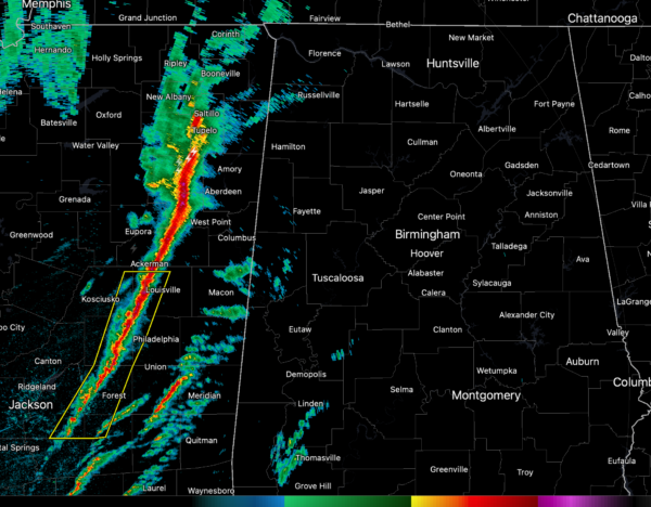
Radar Update at 9 a.m.: Concerns About Increasing Instability
Our line of low-topped thunderstorms is pushing eastward across Central Mississippi this morning. Lightning has been increasing a bit over the last hour or so in the line.
Just after 9 a.m., it extended from Houston to Ackerman to Carthage to Pelahatchie. The line itself is translating eastward at just over 30 mph.
A severe thunderstorm warning is in effect for Attala, Choctaw, Leake, Neshoba, Rankin, Scott, Smith, and Winston Counties.
Here are the approximate times of arrival for the line of storms:
…Marion/Lamar Counties…9:45-10 a.m.
…Pickens/Sumter Coutnies…around 10:30 a.m.
…Tuscaloosa…around 12 noon
…Birmingham…right after 1 p.m.
…Anniston/Gadsden around 2:30 p.m.
There are some breaks in the cloudiness over parts of Central Alabama. Any sunshine that breaks out could really boost instability.
Low-level wind shear is off the charts, so any sustained updrafts that can establish themselves will rotate and will have the ability to produce tornadoes.
Category: Alabama's Weather, ALL POSTS, Severe Weather


