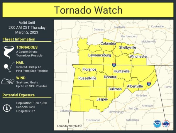
Tornado Watch Issued for Portions of North/Central Alabama Until 2 am
The Storm Prediction Center has issued a Tornado Watch effective immediately for Colbert, Cullman, DeKalb, Franklin, Jackson, Lauderdale, Lawrence, Limestone, Madison, Marshall, and Morgan counties in the Tennessee Valley, and for Fayette, Lamar, Marion, Walker, and Winston counties in Central Alabama.
The NWS Storm Prediction Center has issued a
* Tornado Watch for portions of
Northern Alabama
Southern Middle Tennessee
* Effective this Wednesday night and Thursday morning from 735 PM
until 200 AM CST.
* Primary threats include…
A few tornadoes and a couple intense tornadoes possible
Scattered damaging wind gusts to 70 mph possible
Isolated large hail events to 1.5 inches in diameter possible
SUMMARY… Severe weather/tornado potential is expected to steadily
increase through mid into late-evening as low/mid-level winds
strengthen and storms develop and move into the region.
REMEMBER… A Tornado Watch means conditions are favorable for
tornadoes and severe thunderstorms in and close to the watch
area. Persons in these areas should be on the lookout for
threatening weather conditions and listen for later statements
and possible warnings.
Category: Alabama's Weather, ALL POSTS, Severe Weather


