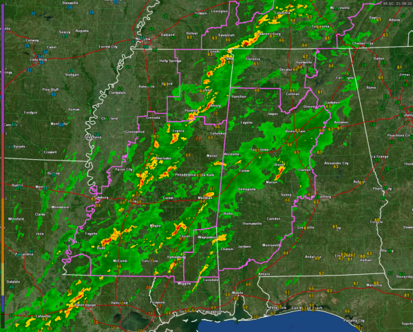
Alabama Weather Update at 3:35 p.m.
Here’s a look at the Alabama weather situation at 3:35 PM.
No warnings are in effect at this time.
Showers and thunderstorms continue across the I 59 corridor all the way from Sumter County up into Etowah County this afternoon.
Dewpoints in this corridor are in the 61° range around Anniston 63 around Birmingham and 65 in Tuscaloosa.
The atmosphere continues to moisten, but the presence of that rain and thunderstorm activity and the morning cloud shield may actually help to hold down the severe weather threat.
There is a strong thunderstorm now between Brent and Marian in south-central Alabama, a fairly strong storm in northern Pickens county, and northern Greene County north of Eutaw. This activity extends back into the eastern part of Mississippi from south of Macon to near Meridian to near Laurel.
The main line of thunderstorms, ahead of the dryline, extends from south of Nashville around Columbia, Tennessee Tenera, to near Amory and then on to north of Jackson in Mississippi. No severe thunderstorm warnings are in effect right now for a part of Alabama, Mississippi, or Tennessee.
We continue at three tornado watches this afternoon affecting the eastern half of Mississippi, the western half of Alabama, the Tennessee Valley, and up into Tennessee.
The threat of severe weather, including the possibility of tornadoes, continues for this afternoon and tonight across the entire state of Alabama.
Category: Alabama's Weather, ALL POSTS, Severe Weather


