A Quick Mid-Afternoon Radar Check
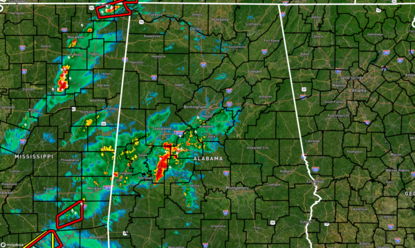
RADAR CHECK: Right before 2:30 pm, we continue to have rain and storms moving slowly to the northeast mainly over Hale County with showers surrounding that cell. At the moment, these are staying below severe limits. This activity could potentially lead to a little more stable air just north of this activity due to the more unstable air being blocked from moving northward.
As a matter of fact, the latest update from the SPC’s Mesoscale Analysis shows a drop in instability values with most locations now below 1,500 J/kg except for portions of Lamar and Marion counties and back westward into Mississippi.
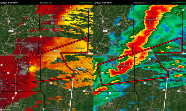
A decent looking rotational couplet has led to a Tornado Warning on this cell moving through the northeastern corner of Mississippi. If the current trends hold together as the cell will move into Lauderdale County around 2:45 pm, NWS Huntsville may have to issue a warning on it.
A tornado watch continues for much of the Tennessee Valley until 7 pm tonight, while a tornado watch continues for much of Central Alabama until 8 pm tonight.
Category: Alabama's Weather, ALL POSTS, Severe Weather


