Mesoscale Discussions: Tornado Watch Coming Shortly for Portions of North/Central Alabama
The Storm Prediction Center has put out its latest Mesoscale Discussion, and it looks like a Tornado Watch will be issued shortly for portions of North/Central Alabama. Here is the text from the discussion…
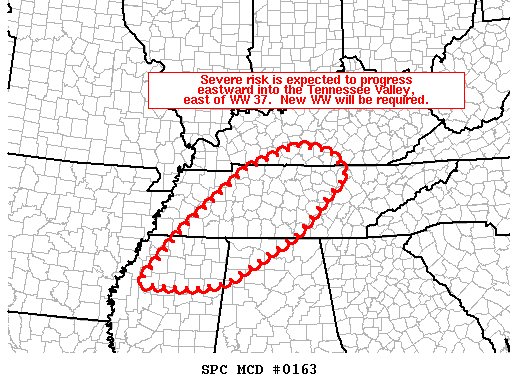
SUMMARY… Severe/isolated tornado risk is forecast to increase somewhat, and expand east across much of the Tennessee Valley area east of Tornado Watch 37. A new Tornado Watch will be needed by 18Z.
DISCUSSION… Latest radar loop shows a sub-severe band of convection moving across western Tennessee and northwestern Mississippi, which will cross the Tennessee Valley area this afternoon.
While instability remains tempered, breaks in the cloud cover will allow some destabilization through peak heating, which is expected to correspond to an increase in storm intensity/severe potential over the next few hours. With a background kinematic environment supportive of rotating storms, a tornado watch downstream of WW 37 will be required soon.
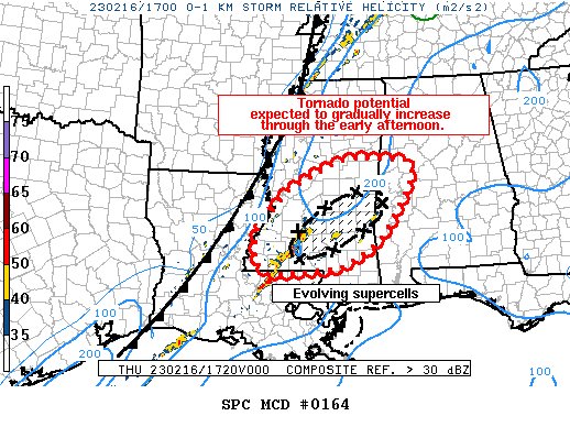
SUMMARY… Supercells are expected to organize with tornado potential gradually increasing through the early afternoon. A corridor of higher tornado potential may evolve from southeastern MS into west-central AL later this afternoon.
DISCUSSION… Over the last couple of hours, radar imagery has shown gradual organization of a few supercells over portions of southern MS. Surface obs and PERILS experimental soundings have shown steady airmass modification and boundary-layer destabilization from southerly low-level advection and cloud breaks within the overlying stratus deck. As temperatures warm into the mid 70s F, increasing theta-E will likely allow for continued intensification of ongoing storms and the development of additional convection in the vicinity. Area VADs show robust low-level shear profiles that have improved over time, with 150-200 m2/s2 of 0-1 km SRH, supportive of low-level mesocyclones. As supercells mature, the tornado threat should gradually increase through the early afternoon over southern MS. A corridor of enhanced tornado potential may evolve into portions of west-central AL later this afternoon as the current supercells shift eastward.
While timing of any downstream watches remains a bit uncertain owing to recent convective imitation near the AL/MS border, a few hours will likely be needed for updrafts to organize to pose a substantial tornado threat. HRRR trends suggest the supercells moving out of southern MS remain the primary threat in the coming hours. However, convective trends will be monitored for any intensification or new convective development farther east into AL.
Category: Alabama's Weather, ALL POSTS, Severe Weather


