Drizzly/Colder Through Tomorrow; Soaking Rain Thursday
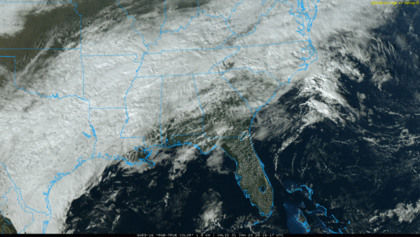
BIG SPREAD: As advertised, there is a huge range of temperatures across Alabama this afternoon. At 2:00p CT… the range was from 40 at Haleyville to 77 at Mobile. Clouds cover much of the state, although the sun is peeking out at times over the southern counties. The cold air over North Alabama will seep southward tonight, and the front will stall out near U.S. 80 tomorrow. Clouds will persist through tomorrow with some scattered light rain.
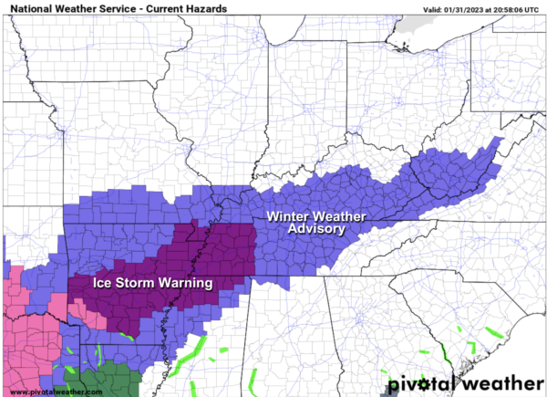
TO THE NORTHWEST: An ice storm warning remains in effect for parts of West Tennessee (including Memphis), extreme Northwest Mississippi, and Arkansas where freezing rain will bring ice accumulation and potential for major travel impact and power outages through tomorrow morning. It will be a very close call for far Northwest Alabama (communities near the Tennessee state line) tonight and tomorrow morning, where light rain will fall with temperatures in the 30-34 degree range.
NWS Huntsville has issued a winter weather advisory for Lauderdale and Limestone counties through 9:00 a.m. tomorrow… be aware some patchy bridge icing is possible around the Shoals over to Athens and Elkmont due to light freezing rain.
Otherwise, tomorrow will be cloudy with some light rain possible; temperatures will be in the 30s and 40s over North Alabama, with 50s and 60s over the southern counties of the state as the big contrast continues. Then, expect a soaking rain Thursday and Thursday night as the main storm system to the west lifts out. Rain amounts of 1-2 inches are likely over the northern 2/3 of the state, with 1/2 to 1 inch for far South Alabama.
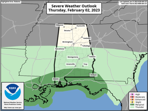
We note SPC has introduced a “marginal risk” (level 1/5) of severe thunderstorms Thursday for areas near the Gulf Coast… a few storms there could produce gusty winds, and there is a low end threat of a brief tornado or two.
But, for most of Alabama, there will be little to no thunder Thursday with a cool, stable airmass in place.
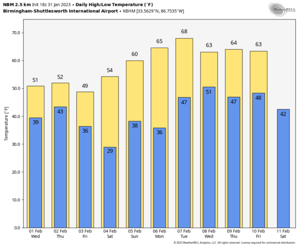
FRIADY AND THE WEEKEND: Dry air returns. Expect a good supply of sunshine Friday and Saturday; the high Friday will be in the 40s over North Alabama, with 50s to the south. Then, on Saturday, highs will be in the 50s and 60s after a cold start. A disturbance will bring scattered clouds Sunday, but at this point the air looks too dry for any meaningful rain. A few isolated showers could form near the Georgia border, but most of the state should be dry with a. mix of sun and clouds.
NEXT WEEK: The weather looks dry and mild Monday and Tuesday; a front will bring a chance of showers, and possibly a thunderstorm, by Wednesday or Thursday. Temperatures should be above average through the week… See the daily Weather Briefing video for maps, graphics, and more details.
ON THIS DATE IN 1979: A winter storm that started on the previous day and ended on this day spread 2 to 4 inches of rainfall in 24 hours over much of coastal Southern California and two inches of snow in Palm Springs. Snow fell heavily in Palm Springs, and 8 inches fell at Lancaster. All major interstates into Los Angeles were closed. Snow drifts shut down Interstate 10 on both sides of Palm Springs, isolating the city.
BEACH FORECAST: Click here to see the AlabamaWx Beach Forecast Center page.
Look for the next Weather Briefing video here by 6:00 a.m. tomorrow…
Category: Alabama's Weather, ALL POSTS, Weather Xtreme Videos


