Tornado Watch Likely to Be Issued Within the Next Couple of Hours
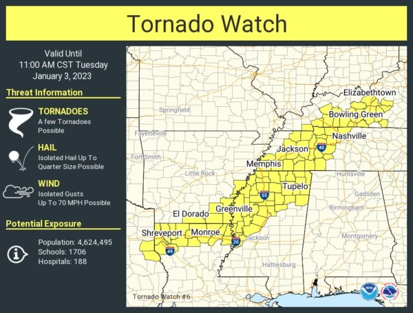
We will most likely have a Tornado Watch issued for portions of North/Central Alabama issued within the next couple of hours, east of the current Tornado Watch that stretches from Central Kentucky down to northeastern Louisiana. Here i the text from the latest Mesoscale Discussion from the SPC…
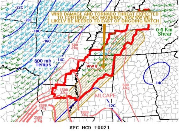
SUMMARY… A severe threat is expected to continue this morning from parts of the lower Mississippi Valley northeastward into the Tennessee Valley. Wind damage and tornadoes will be the primary threats. A new weather watch may be needed to the east of the current watch.
DISCUSSION… The latest regional mosaic radar imagery shows an organized line of strong to severe storms located from eastern Louisiana north and northeastward into western Tennessee. The airmass ahead of this line is weakly unstable in the Tennessee Valley and moderately unstable in the lower Mississippi Valley. According to the RAP, MLCAPE ranges from near 500 J/kg in western Tennessee to about 1500 J/kg in eastern Louisiana. In addition, the line of storms is near the axis of a 50 to 60 knot low-level jet, which is enhancing lift and shear. WSR-88D VWPs near the axis of the jet have 0-6 km shear between 50 and 60 knots and 0-3 km storm-relative helicity in the 300 to 400 m2/s2 range. This shear environment will likely continue to support supercells with wind-damage and tornado potential. The threat should gradually shift eastward, which could necessitate watch issuance later this morning.
Category: Alabama's Weather, ALL POSTS, Severe Weather


