The Late Afternoon Weather Report — Rain Now Approaching the I-65 Corridor
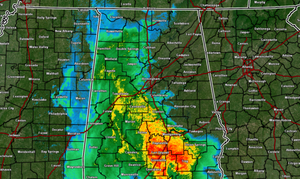
RADAR CHECK: At 3:55 pm, light to moderate rain was approaching the I-65 corridor in the northern half of the area, with moderate to heavy rain approaching the I-65 corridor in the southern half of Central Alabama. At this point, no strong or severe storms are being reported, but much of the western half of the area is getting a decent soaking. Afternoon highs made it up into the lower 60s to the lower 70s, with Alexander City and Sylacauga leading the way as the warm spots at 70 degrees. The cool spot was Haleyville, topping out at 62 degrees. Birmingham made it to 65 degrees.
For tonight, it will continue to be overcast with rain likely over the eastern 2/3rds of the area, while a good chance of remains for the western 11/3rd. There may be a clap of thunder or two, but nearly all of this activity will be just your typical rain. Overnight lows will dip down into the mid 50s to the lower 60s.
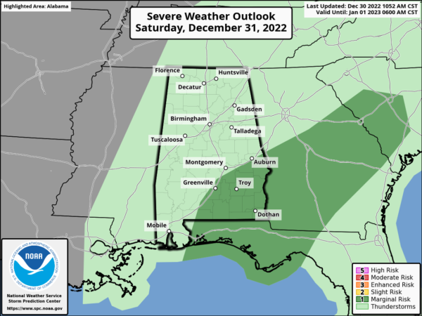
Saturday will start off with scattered to numerous showers mainly east of I-65, with the western half of the area having a decent chance of rain. There may be a few storms over the east and southeastern parts of the area, and the Storm Prediction Center has a Marginal Risk up for locations along and south of the I-85 corridor. Damaging winds will be the main threat, but a brief tornado can’t be ruled out. The good news is the activity will have pushed out of the area by the evening, and it will be dry for the ringing in of 2023. Highs in the mid 60s to the lower 70s, with midnight temperatures in the upper 40s to the upper 50s.
Sunday continues to trend dry with mild temperatures. We’ll have plenty of sunshine and only a passing cloud or two. Highs will op out in the mid 60s to the lower 70s.
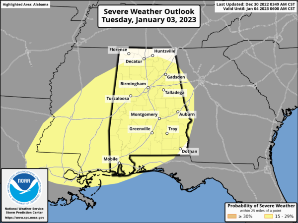
We are still looking at a risk o severe storms and some flooding issues next week. SPC continues to have all of Central Alabama and a good portion of the Tennessee Valley in a Slight Risk for severe storms on Tuesday, as damaging winds and tornadoes will be possible. Probably, the larger story will be the amount of rainfall.
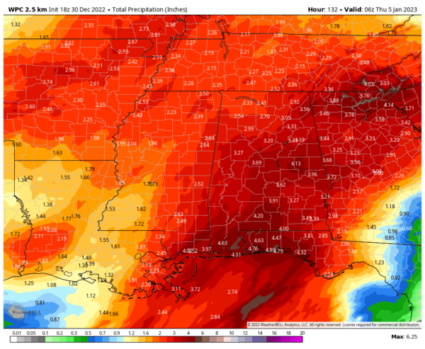
We are seeing projected rainfall amounts totaling up to 2.25 to 4.25 inches across the area through Wednesday at midnight, with much of that occurring on Tuesday and Wednesday. Please stay weather aware, be prepared, and don’t drive onto flooded streets.
Category: Alabama's Weather, ALL POSTS, Severe Weather


