Late Afternoon Weather Check
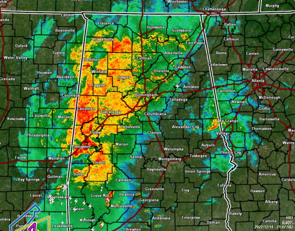
As we approach the 4 o’clock hour in Central Alabama, it looks like we have hit a small lull in activity as there are currently no tornado warnings in effect for Alabama or Mississippi, even though we continue to have moderate to heavy rain falling over the western half of the area. Let us hope that this “lull” continues for the rest of the evening. The only tornado warning in effect at this time is down in eastern Louisiana, which includes the New Orleans metropolitan area.
Instability is currently limited to the counties just south of the area in Southwestern Alabama and back into Southern Mississippi and eastern Louisiana. If that instability moved farther to the north, there is plenty of shear in place to get any updrafts rotating, and we would potentially see a few tornado warning. Helicity values are really high across the area, well above the 250 m2/s2 threshold needed for the increased threat of supercellular tornadoes.
While the opportunity still remains for the more moisture-rich and unstable air to move farther to the north and bring the increased risk of severe storms to the southern parts of the area, it will need to greatly increase as dewpoints are still in the mid to upper 50s from Montgomery northward. For now, that severe risk looks to be very low at the moment.
We’ll be with you through the rest of the afternoon and evening with updates and any new weather advisories, watches, and warnings are issued. Stay aware and be prepared!
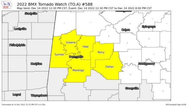
Remember… A PDS TORNADO WATCH continues until 8 pm tonight for Dallas, Greene, Hale, Marengo, Perry, Sumter counties in Central Alabama. This is a particularly dangerous situation as numerous tornadoes are expected with a few intense tornadoes likely, scattered damaging wind gusts to 70 mph possible, and isolated large hail events to 1.5 inches in diameter are also possible.
Category: Alabama's Weather, ALL POSTS, Severe Weather


